Saturday, April 16, 2011

1800 Days – Seg. 17, Ch. 4, Pg. 10-14

    On Saturday, although we wanted to dinghy into Oxford again, it was still too breezy and choppy. We stayed onboard, read and rested, tended to small chores and checked over the boat. And we were disturbed by what we found. Once again, a voltage check showed that the batteries were not fully charged despite running the generator for 13 hours overnight. Worse yet, the foods and ice in the freezer compartment of our refrigerator showed signs that they were starting to thaw. Summer School was equipped with a typical marine refrigerator/freezer, a half size unit fitted into a compartment under the counter of the galley. This unit ran on 120 volt ac power if available from a dockside connection or our onboard generator. If these sources were not available, such as on Saturday morning after we shut down the generator, then the refrigerator automatically switched to 12 volt dc power from our house battery system. I reasoned that, if the battery voltage was low due to a lack of an adequate charge (for whatever reason), then the refrigerator may not be able to cool adequately, especially in the hot weather we were experiencing after the passage of Fran. We therefore decided to run the generator for an extended period and turned it on at 2 p.m., not to be turned off again until 8 a.m. Sunday morning. When we checked the refrigerator at that time our situation was much worse. All the foods in the freezer were thawed.

    It was imperative that we solve this problem if we were to continue our cruise, and our lives, as planned. Was our refrigerator simply failing, requiring us to replace it at substantial cost, perhaps several thousands? If this were the case we would have to spend significant time living in a marina somewhere while we got the unit replaced, which would completely disrupt our plans and our lives. This would be much worse than the problems we had with our air-conditioner.

    Once again I studied the manual for the refrigerator that came with the boat, looking for any hint or clue, and once again I read the specification that, if the refrigerator was mounted in an enclosed space, then that space should be vented with a minimum aperture of 35 square inches. I knew from looking at the vent cover on the outside of the cabin that the vent size was much smaller than this; the vent cover was only about two inches by four. In fact, for this reason I had long ago purchased a 5 by 9 louvered stainless steel vent cover with the intention of someday enlarging the vent to improve the performance of the refrigerator. But to this date our refrigerator had never failed us. On the other hand, we had not anchored for extended periods in weather as hot as what we experienced after Fran.

    There was one way to find out if the lack of adequate venting was the source of our difficulties, and that was to remove the refrigerator from its compartment and see if its performance improved. Although I hated to disrupt the interior of our cabin, I removed the mounting screws and was able to slide the refrigerator out of its compartment and onto the cabin sole without having to disconnect it. I was shocked by what I found. The compartment was not vented at all! The small vent that I could see on the outside of the cabin had been misplaced. That vent hole, which assuredly was meant for the refrigerator, opened underneath the galley sink instead! The wonder was that the refrigerator had been able to operate at all.

    Looking back on our actions on that Sunday morning I wonder at our boldness, but there seemed very little choice at the time. We had to get this problem resolved, and do it ourselves if at all possible. So I restarted the generator at 9 a.m. to provide power for my drill and saw, ran an extension cord onto the outside deck, and, after measuring very carefully, cut a large rectangular hole in the side of the boat. By noon the 5 by 9 vent cover had been mounted and sealed, and the refrigerator replaced in its compartment.

    We turned off the generator and waited. This would be a difficult test since the refrigerator was now running off the batteries and the outside temperature was again in excess of 90 degrees. We were encouraged by the fact that by evening the ice cube trays had started to freeze again though the meats in the freezer compartment were still soft.

    The NOAA weather forecast that night was the best we had heard for almost a week, with predicted hot temperatures but light winds and calm sees on the Chesapeake. If we were going to proceed with our plans to ascend the Potomac and visit Washington this might be the best time to cross the bay. We decided to leave the next morning if the forecast held, cross the bay and anchor somewhere in the Solomons area near the mouth of the Patuxent River.

    We were awake early on Monday morning. The NOAA weather broadcast was still the same, calm waters and light winds, so we got underway as quickly as possible. We left the protected anchorage at Trippe Creek by 8 a.m. to cruise the 45 miles across the bay and southward to the mouth of the Patuxent River. We reasoned that we would anchor overnight there and, if the refrigerator was working well and the boat was otherwise functioning properly, we would leave the next day to head south to the mouth of the Potomac and thence upriver toward Washington. On the other had if the refrigerator was still malfunctioning, or if there were any other significant problems, we would be close to Solomons, which had many marinas and repair facilities.

    On that Monday we were treated to an unusual experience on the Chesapeake. During the entire day the water, even out in the main shipping channel in the middle of the bay, was perfectly calm and flat. It was truly like glass with perfect reflections of the sky. Any disturbance, such as a ripple or a boat wake, could be seen from far away. We saw a number of areas where there were what we call fish boils - areas in the water where the surface was roiled by numerous fish feeding and trying to escape predators. We stopped briefly to fish one of these and easily caught five striped bass and a nice sized blue fish. By 3 p.m. we had entered the mouth of the Patuxent, continued past Sandy Point and the entrance to Solomons harbor, and rounded Point Patience off which the water was, incredibly, more than a hundred feet deep in the middle of the river. We tucked into Mill Creek on the western side of the river (not to be confused with the Mill Creek that flows into the harbor at Solomons) and dropped our anchor in a protected cove under the supervision of two beautiful swans. We were home for another night.

    After settling into our anchorage a check of the refrigerator showed that everything in the freezer was hard frozen; the cutting of the vent hole in the side of the cabin had worked and the refrigerator was probably working better than it ever had.

    Although we still had the problem of the batteries not charging fully when the charger was running off the generator, we thought we could live with this for awhile, at least until we got to a marina in Washington. So we settled in to a hot night on Mill Creek and made our plans to start for Washington and the Potomac early the next morning. Once again, however, Hurricane Fran forced us to change our plans. We learned, when we watched late night news from a Washington channel, that the Potomac was experiencing its worst flood in a hundred years due to all the rain dropped by Fran in the Potomac watershed. Whole trees and parts of buildings were being carried down the river by a current that was described as savage. There was no way we could fight against that current for a hundred miles and cope with all the debris in the water. A cruise up the Potomac and a visit to Washington would have to wait for another time. Of course we had no way of knowing that this anticipated cruise up the Potomac, when it came, would be part of the last cruise we would ever make in Summer School.

Sunday, April 3, 2011

1800 Days – Seg. 16, Ch. 4, Pg. 5-10


    By Monday afternoon most of the boats that had been visiting Chestertown had left. The holiday weekend was over. We departed as well, hauling our anchor at about 3 p.m. We only went about nine miles downriver to anchor one more time in Comegys Bight, the only boat in this pretty little bay that we liked so well.
    Our strategy in making such a short cruise was to position ourselves close enough to Kent Narrows to be there at high tide, about 10 a.m. on Tuesday morning. This, we felt, was crucial. The approach to Kent Narrows from the Chester was notorious for shallow water and shoaling with a high probability for first-time users such as ourselves to run aground. We would need every inch of depth we could get. Additionally, when the tide was running strongly the current through the Narrows was supposed to be fierce. If we could get there at high tide the current through the narrow bridge opening probably would be more manageable though our charts showed that it would not by any means be slack. This no longer surprised us. From our previous boating experience we knew that there was often a significant offset between the times of slack current and the times of high or low tide.
    On Tuesday morning we were up before seven and underway by 8 a.m. Two hours later, despite having considerable difficulty in finding the channel leading from the Chester to Kent Narrows (it was not as shown on the chart and had apparently been recently moved), we were in front of the Kent Narrows bridge waiting for it to open. As near as we could tell it was exactly high tide, though the current was still running strongly from the Chester toward Eastern Bay, pushing us toward the bridge and making it difficult to hold our position. To our relief the bridge tender seemed very knowledgeable about the problems of handling boats in strong currents (this was sometimes not the case we had found), and when he opened the bridge he used a loud PA system to instruct boats waiting on the other side of the bridge to stand back while we rode the swift current through the narrow opening.
    As soon as we entered Eastern Bay we knew that we were in different waters than in the Chester River drainage basin. We saw swimming crabs and stinging jelly fish, called nettles by the locals, everywhere.
    We followed our plotted course south about ten miles, past the wide opening to the main part of the Chesapeake, until we came to the mouth of the Wye River off Bennett Point at the end of a thin strip of land called Piney Neck. There we proceeded carefully across the shoals off the point (there were two marker buoys to help us) and turned north up the Wye River toward Wye Island. The charts showed the main channel of this river to be very deep with usual depths of 30 to 40 feet and sometimes as much as 50 to 60 feet deep. After the shallow water we had been through it was a pleasure to cruise through such depths, though we had to be attentive not to stray too far from the main channel, as we soon discovered, because the water shoaled quickly on either side. We planned to continue to follow the main Wye River north, past the mouth of the Wye East River that marked the tip of Wye Island. There were several places that promised good anchorages north of the island. We intended to take two or three days to explore ashore by dinghy and, finally, to circumnavigate the island before coming back out on the Wye East River on our way to Oxford and the Choptank River area.
    As we cruised slowly up the river we came fairly close to the shore of Piney Neck on our west. After about two miles we came abreast of a large stately house with extensive grounds, and all over the lawn and in the waters near the shoreline was a large flock of Canada geese. In addition we saw a flock of brilliant white swans. They were stunning in their grace and beauty. And then Nancy yelled at me to watch the depth gage, we were in the shallows. In my excitement over the geese and swans I had allowed the boat to drift too close to shore. But, thanks to Nancy's attentiveness, no harm was done and I turned back into the main channel, thrilled by the sight of these magnificent birds and eagerly anticipating the prospect of exploring this area over the next several days. Less than a mile beyond the house we rounded a large point of land, Drum Point according to the charts, extending from Wye Island on our right. On the other side of the point we entered a sheltered bay and there we decided to stay. We had this seemingly secluded anchorage all to ourselves throughout the night.
    Wednesday morning arrived early and abruptly in the form of wakes that threatened to rock us out of bed. These, we found, were due to work boats traveling up and down the main river channel as well as two boats that were tending crab traps in our little bay. But there was nowhere we had to go on this day. Maybe we would just travel a little around the shore of Wye Island. We could take it easy, get naps and have a restful time. So we eased into the morning, lingering over coffee, juice and toast, talking about how we would explore the area.
    Finally, at 10 a.m. we turned on the VHF radio and listened to the NOAA weather broadcast, and that changed everything. We were shocked to learn that there was yet another hurricane coming, Hurricane Fran, and it was forecast to come ashore in North Carolina and move up the Chesapeake. It was stated that the weather on the Chesapeake was expected to deteriorate as early as the next day, Thursday. It was evident that, if we were going to get to Oxford and the Choptank, we had better leave immediately or we would risk being windbound on the Wye River where there was no nearby town where we could resupply if that became necessary. We scurried about getting everything ready, finally hauling our anchor and getting underway by 11:15. How quickly our plans had changed!
    It was about a 45 mile cruise to Oxford and there was no short cut this time to keep us in sheltered waters. We had to proceed out the mouth of Eastern Bay south of Kent Island, all the way to the main shipping channel of the Chesapeake to skirt the shoals off Poplar, Jefferson and Coaches Islands. As we approached the main body of the Chesapeake we encountered southerly winds to 20 knots that resulted in head seas of about four feet. We left the bridge and went below in the cabin to use the lower helm station where it was less bouncy and out of the wind. This was the roughest water we had encountered since our tour of the Bahamas. Every wave produced a shower of spray over the bow that crashed onto the front window. We had to round Tilghman Island to enter the broad mouth of the Choptank and there is extensive shoaling that extends for more than six miles off the southern tip of the island. Fortunately we were able to carefully cross these shoals using a path that had adequate depths for our boat. Once we were into the Choptank the water calmed appreciably. We headed upriver toward Oxford, which is situated on the neck of land where the Tred Avon River enters the Choptank. Up the Tred Avon, about two miles past the Oxford waterfront, we turned into Trippe Creek, which made off to our right. A mile up the creek we rounded a sharp point of land at a narrows and carefully favored the south shore. We were in what was really like a little bay about a half mile wide but very well protected. Charted depths were 7 to 10 feet. Perfect, we thought, not too deep yet with adequate swinging room. We could safely let out a lot of anchor line to give us the large scope necessary to withstand high winds. It was late, almost 6 p.m., when we dropped our anchor. It had been a boisterous ride but we were now in a spot that we thought would be a good hurricane hole and it was only three miles from Oxford where there were restaurants, marinas and stores for reprovisioning.
A Marina in Oxford: Swans Are Common

    The Trippe Creek anchorage was our home for the next five days and I have nothing but good memories of this time despite Hurricane Fran. On Thursday, the day after we arrived, we took Recess into town where we found a convenient dinghy dock at a restaurant. We had an excellent lunch, disposed of our accumulated trash from the boat, and got a cooler full of ice for our drinks. On our return trip to Summer School in the early afternoon the winds increased and the water became sufficiently choppy that we were taking in spray over the bow of our little inflatable dinghy. Back onboard, NOAA weather radio confirmed that Fran had come ashore in North Carolina and was expected to churn up the Chesapeake still at hurricane strength. We set out a second anchor and adjusted our lines to give us plenty of scope. We were about as well protected as we could hope to be.
    I slept little on Thursday night as the winds increased, preferring to stay awake to watch the radar, GPS receiver and depth gage so that I could detect any appreciable movement of the boat caused by anchor dragging. I dozed fitfully through the early morning hours as the winds seemed to be holding steady at around 30 mph. I was glad when dawn finally came and revealed our bay to be covered in whitecaps. The early morning weather report brought good news, at least for us. Fran was tracking west of the Chesapeake and we would miss the worst of the storm. As the day wore on the winds increased somewhat to 35 mph but we were secure and unworried in our anchorage. In the afternoon Nancy and I sat in our small cockpit at the back of the boat, warmly comfortable and shielded from the wind. We still had a few chicken necks in the freezer compartment left over from Rolph's, and we used these to crab from the back of the boat. By dinner time we had caught eight beautiful large blue crabs and these became the main course of our dinner. Altogether it was an enjoyable and memorable afternoon. I was aware that there must have been some storm surge due to Fran because there was a house on the shore about a half mile away that had a boat dock, and the dock, as best as I could see, had disappeared under the water. However, since we were at anchor we merely rose with the water level, which had essentially no effect on us. By nightfall the winds had started to diminish and the temperature had increased substantially due to the tropical air brought into the region by the hurricane. The low temperature never got less than 75 overnight but we had our generator and air-conditioner. We were comfortable.
House on the Shore at Trippe Creek Anchorage
Dock Submerged by Rising Waters from Hurricane Fran


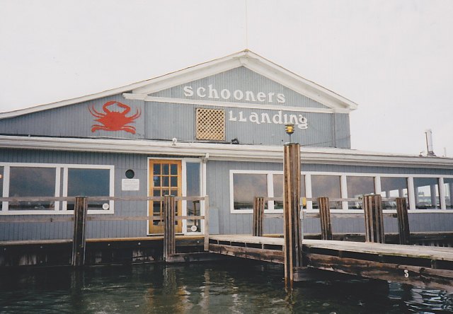
Restaurant on the Shore in Oxford
Flooded at High Tide During Hurricane Fran

Friday, March 18, 2011

1800 Days – Seg. 15, Ch. 4, Pg. 1-5

Chapter 4 - Chesapeake Explorations


    Even studying charts and maps does not adequately convey what a remarkable body of water is the Chesapeake Bay. You have to explore it, experience it first hand and at close range. To realize that it is the country's largest estuary, to know that it is almost 200 miles long, does not tell even a fraction of the story. The shoreline of the bay is immense, scalloped into many bays and peninsulas and islands. Many large rivers enter the bay on both the eastern and western shores, some extending for more than a hundred miles inland, and each of these invites further exploration. We were a little acquainted with the upper bay through our recent cruise to Havre de Grace, and of course we began our life with Summer School on the Sassafras River on the upper eastern shore. But we knew little of the middle and lower bay regions having merely passed through these areas on our way south and north, yet most of the large bays, islands and rivers occurred in these areas. We thought we had a wonderful opportunity for a leisurely exploration of this part of the bay from the end of August through the middle of October, possibly even the beginning of November, until falling temperatures drove us south.

    But first we had to get through Labor Day weekend. We did not want to be traveling on the water during the madness of this holiday weekend. Neither did we wish to remain at Rolph's and be buffeted by the wakes from all the boat traffic that was sure to occur. So we left Rolph's on Friday, August 30, and traveled just two miles upriver to Chestertown where we anchored in the middle of the river opposite the town waterfront. This area was an enforced NO WAKE zone, an established anchorage with marinas on the shore, and we hoped to be able to enjoy the charms of Chestertown, this time from the water, for one last weekend. Friday was Day 110 of our new lives.

    We dropped our anchor at 11 a.m. in the middle of the river and a little south of Kibler's Marina and the Olde Wharf Inn. Considering expected boat traffic, depth, and possible swinging room, we thought that this was an ideal location even though we were about a half mile from the town dinghy dock on the waterfront next to the inn. We made sure that our anchor was very well set in the thick mud of the river and we let out 150 feet of anchor line to give us adequate scope in case of a strong wind. This was a real possibility since Hurricane Edouard, a category 4 storm with winds of 140 mph, was churning a thousand miles away but heading to the mid-Atlantic coast. It could affect us as early as Sunday if it came our way.

    We spent the remainder of Friday quietly on our boat, resting, reading, doing a little boat work, watching other boats come into the marina or anchor off the docks. The weather was perfect with clear skies, light winds and afternoon temperatures in the low eighties. We started the generator at 5 p.m. so we could watch the news of Edouard on television and cool the boat with the air-conditioner. After a dinner of fresh flounder, potatoes au gratin and chilled white wine we settled in for the night, feeling happy and secure in the middle of this beautiful river. After dark, through our large port salon window, we watched a nearly full moon rise through the trees on the shore. We felt worlds away from Rolph's Wharf.

    Our nearly perfect weather continued on Saturday though the temperatures were slightly warmer. The morning weather discussion from NOAA suggested that Edouard may veer away from a landfall on the coast so we were hopeful that we might be able to escape dealing with a hurricane. We lowered Recess into the water off the swim platform, mounted its three horsepower outboard, loaded the life-preservers, spare gas can, oars and various other items that we always carried when traveling in the dinghy, and pulled away from Summer School by mid-morning, anxious to visit Chestertown, which was having its "first annual" jazz festival in the city park on the waterfront. We remained for several hours in the park listening to the music and lunching on hot dogs and beer.

    In the evening we again took our dinghy into town to enjoy a celebratory dinner at the Olde Wharf Inn. The next day, Sunday September 1, would mark exactly seven years since we spent our first night together and this was a much more meaningful anniversary to us than August 1, which corresponded to our actual marriage in 1994 that took place in the office of a ReMax real estate broker while we were on our way to do some shopping in Marathon. This marriage was a merely practical step we took to be certain I could keep medical insurance if I quit my job. The September 1 date, in contrast, was the anniversary of our emotional commitment. After large and satisfying dinners we took Recess back downriver to our boat, weaving through the other anchored boats in the darkness with only the light of the moon to show us the way across the water. It seemed magical riding across the river in the moonlight where we could easily see the small ripples and eddies caused by the current. Back onboard Summer School we turned on the generator and the air-conditioner because the night was still warm.

    Sunday morning brought both good news and bad. The good was that we had escaped Edouard. The morning NOAA weather report stated that the hurricane had taken the hoped-for turn to the north and would stay well off shore. This was a major relief and we felt that now we could proceed with our cruising plans.

    The bad news was that on my routine morning check of the engine room, the battery voltage of our house batteries was low at 12.32 volts under no load. This value indicated that the batteries were only about half charged despite the fact that the generator, and therefore the battery charger, had been run overnight for 12 hours. This length of time should have been more than sufficient to charge the batteries fully, which would have produced a no-load voltage of 12.6 volts minimum. I did not know whether our golf-cart batteries that we used for the house batteries had begun to deteriorate or whether we had some other electrical problem. In either case the problem had to be resolved. We needed to be able to stay at anchor for extended periods of time without constantly running the generator.

    Despite the nagging worry caused by the battery problem, Sunday was a quiet peaceful day. Except for a dinghy ride through the anchorage we stayed onboard, had a good brunch followed by short naps, watched the opening game of the NFL season, and talked about the various possibilities for our fall cruise on the Chesapeake.

    We consulted the charts and the cruising guides and discussed the areas we would most like to see. There were so many possibilities that we knew we had to be very selective. In the end we decided that we would take September and most of October to explore the middle of the Chesapeake, the area roughly between the Bay Bridge connecting the eastern to the western shore near Annapolis, and the Maryland-Virginia border. The highlight of our cruise was to be a 100 mile trip up the Potomac River to Washington, D.C., which we wanted to do a little later in the fall when the temperatures would be cooler.

    Before then, we intended to explore the eastern shore of this section of the bay. When we left Chestertown we would follow the Chester downriver in a generally southwest direction. Before the Chester enters the Chesapeake it makes a big sweeping turn to the north to get around Love Point, the northern tip of Kent Island, which is a large island running about 15 miles from north to south, and connected to mainland Maryland by a bascule bridge over a narrow channel of water called Kent Narrows. By transiting Kent Narrows it is possible to go directly from the Chester River to a large bulge in the Chesapeake called Eastern Bay, and we were very interested in this area. At the northern end of Eastern Bay was Wye Island, a Natural Resources Management Area owned and managed by the state of Maryland and known for its wildlife including a resident population of swans. At the southern end of the bay was the Miles River and St. Michaels, which we had enjoyed so much when we visited it by car. St. Michaels itself is on a narrow neck of land on the other side of which is the large complex of waterways at the mouth of the Choptank River, another of the major rivers on the Eastern shore. It was home to the attractive small towns of Oxford and Cambridge, which we had also visited once by car. Good anchorages abounded throughout all of these waters, and any of the towns would make interesting stops to sight-see and reprovision. We thought we would explore these areas before crossing the Chesapeake to begin our trip up the Potomac to Washington. It seemed a good and simple plan, and we were anxious to begin. We had no way of knowing on that Sunday just how much the weather would change it.

**********

Saturday, March 5, 2011

1800 Days – Seg. 14, Ch. 3, Pg. 14-24(end)


The Manor House at Rolph's Wharf
    Rolph's Wharf was more than a marina. It was a multi-faceted business run by a young middle-aged couple, Chip and Sandy, and centered around a beautiful old manor house dating from the 1830s that they owned and operated as a country bed and breakfast establishment named the River Inn. On the five or six acres of beautiful grounds surrounding the house there were shade trees and picnic areas, an in-ground swimming pool (available for use by residents of Chestertown as well as patrons of the marina or inn), a swimming beach on the river, a restaurant and a field that was used as a dry dock area for the boats that were stored there. There was a launching ramp and small boats for rent (both of these facilities used primarily on the weekends by people from town). The marina itself was small, only about 40 slips total. It was comprised of two piers that extended out into the river at right angles to the banks. The northern-most pier was the smaller of the two; it contained the marina office, some slips for smaller boats and a fuel dock at the end. The southern pier contained slips suitable for larger boats up to about 40 feet. When we arrived, there were a few older cruising boats and a number of large houseboats moored on this pier. We took a slip towards the far end where the water was deep enough (barely) to accommodate our four foot draft.

Our Dock at Rolph's
     Rolph's Wharf was located on the east side of the river as it made a big sweeping bend from the southeast to the northwest before it approached Chestertown, only two river miles upstream. The river was still big here with a width of a half mile. From the shore at Rolph's you had an unimpeded view upstream for more than a mile toward the bend in the river below Chestertown, while you could see three miles downriver to where it curved around Northwest Point. While these clear views enabled us to watch spectacular sunsets and gave us a feeling of space, particularly after the confines of the hill-sheltered basin at Summit North, they also meant that Rolph's Wharf was exposed to long stretches of the river and open to whatever wind and waves developed, a feature that led to some problems while we stayed there. Nevertheless it was good to be on a river with movement and life in the water after the near stagnation at Summit North.
One of our Sunsets from Rolph's (Typical)
    The day after we arrived we retrieved our car from Summit North and arranged to have our mail forwarded to the post office in Chestertown. In this way we quickly became settled in our new location. We were well pleased, delighted by the appearance and facilities at Rolph's, the surrounding rural countryside, and the amenities and character of nearby Chestertown. It did not take us long to decide to remain at Rolph's until the end of August, and Chip seemed glad to have us there. With our status as coastal cruisers and full-time live-aboards we were very much a novelty among the local boats that seldom left the dock and never traveled far.
    Although there were exceptions, our days at Rolph's were mainly quiet and happy and full. During the almost two months we lived there on our boat, our life was essentially a pastoral idyll. Typically, during the morning, I worked on my writing in the office in the forward cabin. Nancy would frequently take a long walk as part of her conditioning program and then work on some of her projects, perhaps an article she was preparing for possible publication in one of the boating magazines. After our sandwich lunch we would work on the boat if that were needed and we would often tend crab traps that we set out from the dock during this time. (The Chester River is justly famous for its number and quality of blue crabs, and we always caught enough, almost without trying, for a delicious appetizer or, occasionally, a complete meal.) If boat work did not demand our attention we sometimes drove to Chestertown for shopping, mail or other errands. Frequently we went for bike rides. There was a paved road, Rolph's Wharf Road, that we could follow for about two miles to the intersection with Highway 213. The road was bordered by fields of corn and other crops, the grades were gentle and the traffic was always light. It was ideal for biking. There was a local vegetable stand near the intersection with 213 and we frequently brought back fresh vegetables. On hot days we sometimes swam in the pool before showers and dinner, after which, in the evening, we almost always walked around the grounds and the marina, or perhaps we would fish from the end of our dock. (In contrast to the crabbing, fishing was unproductive while we were there.) The time after dark was reserved for reading, writing in our journals, sharing our ideas or discussing our plans and future possibilities. We always had our nightcaps before bed.
Dinner - A Pot of Blue Crabs Ready for Steaming
    Unless you are familiar with the complexities and potential problems of a full-time live-aboard cruising boat it may seem strange that working on our boat played such a significant and continuing part in daily activities. But since Summer School was our only home and, in addition, we depended on it to take us to various places along the east coast through many different kinds of conditions, its proper functioning was absolutely critical to our lives. It would not do to have our main engine, the Perkins diesel, fail as we were crossing one of the large sounds in North Carolina or Georgia, or perhaps cruising the open ocean from Florida to the Bahamas as we had done previously. Such a failure would not only be hazardous, but it would be extremely expensive to have our boat towed to a repair facility or marina. But beyond this, neither could we maintain our planned life-style with extended periods at anchor if our old diesel generator, Tommy, failed. There were potentially serious or dangerous problems with many other things as well: our fresh water system, our air-conditioning system, our waste disposal system, the propane system, the boat's steering gear, the anchoring system, the navigational systems, etc. Not only could our lives be negatively impacted by failures in such areas, repair or replacement of almost anything on a boat could be very expensive and could significantly deplete our small financial resources.
    We knew that regular care and preventive maintenance were absolutely necessary to the success of our adventure. One of our main accomplishments while staying at Rolph's was the development of a series of computer spreadsheets to help us schedule checks, inspections and routine maintenance. We also used this spreadsheet system to help us keep track of the contents of the various onboard storage areas including necessary supplies (engine oils, transmission oils, engine coolant, etc.) and spare parts (impellers for the various pumps, fan belts, oil and fuel filters, water and waste valves, etc.). The spreadsheets listed each task together with the corresponding service interval (weekly, monthly, every 200 engine hours, etc.), and provided a series of spaces where we could fill in the date that each item was performed. Without these spreadsheets we had already found that keeping on top of needed maintenance was difficult and confusing. When was the last time the head drains were treated? When did I last check the water levels in the batteries? When did I last change the outboard gear oil? When did I last change the oil and filter in the main engine? In the generator? When did I last check the packing around the propeller shaft? And on and on and on. Now we hoped to be able to keep track of the myriad tasks necessary to the proper upkeep and maintenance of our traveling home on the water, and we hoped that this would help spare us unnecessary delays and plan changes, major unexpected expenses, and perhaps even hazardous situations. Not only did future developments confirm our expectations, but the boat work we did at Rolph's, both the mental as well as the physical, gave us great satisfaction and helped add depth and purpose to our lives.    
**********
    But of course we had to deal with some problems while at Rolph's, problems due to the exposed position of the docks on the river, problems due to weather, difficulties with some of the old-timers on the docks who had been coming to their boats at Rolph's for years, and problems with my health. But we tried to learn from all of these, to develop strategies that would help us cope.
    Rolph's was on the east side of the river and the arrangement of the marina was such that the boats, as they lay in their slips, were aligned parallel to the river. The problem with this was that any boat traveling on the river at speed would produce a wake that would send waves toward the shore that would strike the moored boats broadside and cause them to rock from side to side and bounce up and down. If the boat on the river was large and moving at anything other than a slow idle speed the waves it produced could be several feet high and the effects on the boats tied to the docks could be severe; the boats would toss violently pulling hard against the dock lines, perhaps knocking things in the cabins onto the floor or hitting the docks or the finger piers or the pilings. Real damage could be done. People standing on the decks could be knocked down and injured. There was not any Coast Guard sanctioned NO WAKE zone near the marina so transiting boats did not by law have to slow down. Chip had put out two small NO WAKE buoys at either end of the marina, but these had no legal status and were very difficult to see from a traveling boat in the middle of the river. Although maritime law held that any moving boat was legally responsible for any damage caused by its wake, this was no consolation for the anxiety caused by trying to hold the pans on the stove when cooking dinner or, even worse, trying to keep from being thrown off the boat when working up on the bridge. Also, a fast boat was gone and out of sight by the time its wake hit the marina. I think that many of the boats did not even notice the marina because it was small and the river was wide. One day, even a Coast Guard boat passed up the river at speed creating a troublesome wake. When Nancy called them on the radio they slowed down immediately and apologized but of course by then it was too late, the wake had already been created. The wake problem was especially severe on weekends.
    Other worries caused by our exposed position on the river were created by the weather. This was a real concern to us since shortly after we arrived at Rolph's, Hurricane Bertha came plowing through the Atlantic toward the North Carolina coast. Although hurricane-force winds would make the river extremely rough and generate high uncomfortable wave action, the really significant dangers would be caused by the force of the winds on the boats at the docks and the tidal surge that developed. At our slip the surface of the pier was only about two feet above the normal high water mark. The end of the dock at the T-head was even lower. A significant surge could put the docks under water and leave us stranded, if we were on the boat, or unable to get to the boat if we were on shore. An even greater problem would be caused by the effect of the wind and surge on the boats and the dock structure. A tidal surge of five feet, say, would tend to raise the boats five feet in the slips. If the docks were fixed as at Rolph's, as opposed to floating as at Summit North, and the docking lines were not able to accommodate this increase in height, an enormous strain would be placed on the lines, the boats, the pilings and dock structure with consequent serious damage. Yet if too much slack were left in the lines, the boats would be blown about violently in the slips before or after the surge, crashing into pilings and other parts of the docks. In the worst case pilings would be pulled free of the bottom, the docks would break apart and everything would be carried away by the wind and the tides. It is for this reason that many marinas required boats to be removed prior to the arrival of a hurricane, either by finding a sheltered anchorage (a "hurricane-hole") or other safer moorage with strong floating docks, or by having them hauled and stored on land.
    On the night of Thursday, July 11, just nine days after we had arrived, we studied the charts of the local area to see if we could find a hurricane-hole in nearby waters. Bertha was forecast to slam into the North Carolina coast on Friday and then come up the Chesapeake before heading out to sea again through the New York City area. We found that, about ten miles down the Chester, another river entered from the west called the Corsica River, much narrower than the Chester. The charts showed that adequate depths, yet without being too deep, were held to well upstream. Of real interest to us was a place about three miles up the Corsica, sheltered from the larger expanse of the Chester by several points of land, where a narrow creek entered the Corsica on its north bank. This was Emory Creek. Two depth soundings were shown on the chart: one at eight feet and, farther up, another at six feet. If these were accurate, and if we could find our way into the creek past the inevitable shoals near the mouth, we might find excellent protection there, perhaps even being able to tie mooring lines to trees along the banks. However, we would certainly need to explore this creek carefully, preferably by dinghy, before attempting to use it.
    By Friday, our weather began to deteriorate. Although Bertha had made landfall in North Carolina causing major damage, it was predicted that it would lose considerable strength before entering Chesapeake waters. We decided to remain in our slip at Rolph's rather than risk the exploration of new waters in deteriorating weather. We retied our boat more in the center of the slip with as much clearance as possible from pilings and the dock, adding extra lines and securing all our lines in such a way that they were as long as possible. Up on the bridge we folded up the Bimini top. Everything that was not tied down on the bridge and the decks was moved to the interior of the boat. And then we waited. Rain began in the afternoon and by night it was a torrent with rising winds. There were small leaks from the forward and aft hatches and from one of the windows in the aft cabin that kept us busy mopping up. At about 11 p.m. we went to bed amid the sounds of strong wind and lashing rain. I was awakened at 4 a.m. on Saturday morning by the sound of strong winds and the boat tugging hard on the mooring lines. The wind continued throughout the day but it was far from hurricane strength. The highest gust we recorded on our weather station was 39 mph. Nevertheless we experienced a significant storm surge that caused the low tide to be higher than the normal high tide. For a while the end of the dock at the T-head was under water. But there was no serious damage either to ourselves, other boats or the marina itself. By late Saturday afternoon the wind had subsided and the sky had cleared. We felt very fortunate.
Brushed by Hurricane Bertha - Docks beginning to Flood
    About ten days later we did cruise to the Corsica River and anchor there overnight so we would have ample time to explore Emory Creek. We had a fine anchorage at the mouth of the creek, and we found the creek itself to be just deep and wide enough to accommodate Summer School if we needed secure shelter during some future storm.
    Throughout all our time at Rolph's I had periodic bouts with the ulcer condition that had plagued me for the past year. At times I had a gnawing ache in the pit of my stomach. I regularly took Zantac and, during times of the worst attacks, I took Pepto-Bismol several times a day. On July 16 we drove to Philadelphia for my regularly scheduled visit to Dr. Mason. He was pleased with the status of my leukemia: my white cell count was in the normal range and my platelet count, while still low, had increased significantly. However, he was quite concerned with my continued stomach problems. He strongly urged that I see a GI (gastro-intestinal) specialist and provided me with a list of doctors he would recommend. However, I demurred, still hoping that this problem would go away now that we had our happy lives on the boat. But by the end of the month it had become worse, and I consulted with one of the specialists, a Dr. Ruffini in Delaware. On August 7 Dr. Ruffini performed an endoscopy and biopsy of my esophagus and stomach, a procedure I had been dreading, at Cristiana Hospital in Delaware. The results showed that I had scarring from an old peptic ulcer, a moderately sized hiatal hernia, and small areas of erosion in the esophagus. The biopsy was negative. He prescribed Prilosec, which was at that time a new and powerful drug for the treatment of such conditions, and told me that I probably would have to take it indefinitely. However, he promised it would eventually relieve my discomfort and for that I was grateful if perhaps a little skeptical.
    Our problems with people on the dock were not nearly as serious as those due to Bertha or my health, but they were nevertheless annoying. The dock was populated by three houseboats and an equal number of older cabin cruisers. All these boats were used mainly for live-aboard bases on weekends and summer vacations. The people formed a tightly linked social group that had been coming to Rolph's for many years. For their purposes they had an ideal situation: very inexpensive long term slip rentals; beautiful grounds complete with picnic tables and a large gas grill available for their use; easy access from their homes in Pennsylvania, New Jersey and Delaware; excellent crabbing right from the dock and elsewhere in the nearby waters; reasonably good fishing especially for striped bass (usually called rock-fish locally) in season. They usually arrived on Friday evening and took over the dock and the grounds. They had been the only ones on the dock for so many years that they acted as if they owned it, and it was this attitude and the actions resulting from it that we found annoying. Soon after they arrived late on Friday afternoon they would put out their crab traps from almost every piling and post on the dock including the ones in our slip. These would be tended at frequent intervals throughout the weekend. They would set out a lot of equipment onto the dock including their deck chairs, which they arranged in a group so that they all could sit and visit and chat, at a location between our slip and the shore. Every time we walked down the dock we had to excuse ourselves and ask them to move so we could get by. Similarly, they took over the picnic tables and the grill on shore for their pot-luck suppers and crab boils, automatically assuming that they were the only ones to use these facilities, which were thus not available for us or any other transient boaters who might come in to Rolph's for the weekend. Such transient cruisers (and there were not many during our time at the marina) would also have to run the gauntlet down the congested dock through the group sitting on the deck chairs. Most other marinas that we knew would not have allowed the docks to become congested and blocked, but apparently this had always been the way at Rolph's. We were outsiders, different, not part of the group. Although these people were reasonably polite (though certainly not considerate), at least at first, it was obvious that our residence on the dock was not entirely welcome. As we continued to stay, there came to be increasing friction. During the latter half of our time at Rolph's we usually left the marina for much of the weekends, using this time to explore the local area or enjoy the facilities and activities in Chestertown. This practice also spared us the worst of the problems due to the wakes of passing boats.
    Despite the few difficulties we encountered at Rolph's, in the balance our experiences were good and we enjoyed our lives there. Besides, two events occurred that summer that made it easy to put our little problems in perspective. On July 27 a bomb exploded at the Summer Olympics killing 2 and injuring 110. Previously, on July 17 TWA Flight 800 dropped out of the sky off Long Island, killing 230 people, perhaps destroyed by a ground-launched missile as some claimed. What kind of a country were we living in, I asked in my journal. Our lives on the boat seemed far removed from these things, for which we were glad, and our little problems appeared to be very insignificant.
    As we neared the end of August we became very restless. We were anxious to be on our way, to take the next step in our adventure. We had come to the conclusion that we would spend the winter somewhere in North Carolina, perhaps in Beaufort, which we had enjoyed so much on our cruise north the previous year, and where, we had heard, there were good winter rates on slip rentals. We eschewed going to Florida, as ever trying to avoid crowds and congestion. And we thought that perhaps on the North Carolina coast we would have enough of colder weather to satisfy our desire for a change of season without having temperatures so low that there would be resulting problems to worry us such as water freezing. But we did not want to head south toward North Carolina while there was still the likelihood of encountering really hot weather. Instead we decided to take some time during the fall to explore part of the Chesapeake, something that we had always wanted to do.

Friday, February 18, 2011

1800 Days – Seg. 13, Ch. 3, pg. 8-13

    By Wednesday, June 19 and Day 38 of our new lives, we were ready to go. All the boat work that we had deemed essential had been completed. Although we still had a long list of things we wanted to do, Summer School was now much safer and more comfortable, and the boat was well prepared for the rigors of cruising, or so we thought. Again we were confronted with the question of where to go. Of course, it was possible to stay at Summit North but our annual lease would soon expire and the monthly rates without such a lease were expensive. We had to make a decision.

    We knew that there was a maritime festival at Havre de Grace, Maryland, on the mouth of the Susquehanna River at the northern headwaters of the bay, with festivities lasting from Friday, June 21 through Sunday, June 23. This was not far from our location, only 25 to 30 miles we estimated, and it was in an area of the bay that we had never visited. Havre de Grace was a familiar name to me since my boyhood days but I had never been there, although I had always heard it was a very attractive small town. Our perusal of the cruising guides confirmed this impression, and we decided we would go there in Summer School. Havre de Grace is seldom visited by migrating boaters on the Chesapeake since it is off the main navigational channel at the northern end of the bay. But just the fact that it is at the mouth of the Susquehanna made it an interesting destination for us. This river, we read in the guides, contributes about half of all the fresh water that feeds the Chesapeake, an astonishing fact when you consider the size of the bay and the many large rivers, such as the Potomac, that enter it. A trip to Havre de Grace would be a good shakedown cruise, we thought, and it would introduce us to a small town where we just might find a slip for a month or two. If this was not the case, perhaps this short cruise might at least attenuate our impatience to be off traveling in our boat.

    We left after lunch on Friday. It was a clear warm summer day with a brisk northwest wind. As usual we followed the canal to the Elk River, on past Town Point and the mouth of the Bohemia River to where it empties into the bay proper at Turkey Point. Instead of continuing on the main shipping channel to the south, however, we turned to the west toward Spesutie Island and the western shore of the bay, which is off limits to boaters in this area because it is part of the huge military complex of Aberdeen Proving Grounds. Once clear of the extensive shoals that build south from the mouth of the Susquehanna, we followed a marked channel to the north. We were heading into a 20 knot wind which gave us a two foot chop but it was a pleasure to be out in the open traveling on our boat. We followed the channel for eight miles, passing a large Coast Guard boat on our way that also seemed to be heading to the maritime festival. According to our new cruising strategy we kept our engine speed to about 1600 rpm, which gave us a "speed over the ground" against the current and wind of about 6 mph. We arrived at Havre de Grace at 5 p.m. where we took a slip at the Tidewater Marina right in the center of this small town.

    Once ashore we found that Havre de Grace was a delight, even exceeding our expectations. It was a good walking town with broad shady streets lined with old and sometimes spectacular stately homes. There were interesting shops, two museums (the Maritime and the Decoy), and a number of good restaurants. We had an excellent and leisurely dinner at MacGregor's overlooking the harbor.

    We were well satisfied with our cruise during the day and our evening ashore, but there were two occurrences that marred the whole experience. One was a bout of strong ulcer pains before dinner that forced me to sit on a bench and wait until they subsided. The other was what we found when we returned to the boat at 10 p.m.

    I knew immediately that something was wrong as soon as we arrived because there was no seawater discharge from the air-conditioner pump coming from the through-hull fitting on the side of the boat above the water line. It had been a warm evening when we had departed the boat and we had left it closed up with the air-conditioner on. In our absence the air-conditioner had shut off for some reason and the interior of the boat was now stifling. There was no alternative but to change clothes and go to work on the boat to try to find the cause of the problem. The outside temperature had remained high and I knew that sleep would be almost impossible for us without air-conditioning, especially since the interior of the boat was so hot.

    I had always felt that reverse cycle marine air-conditioner/heater systems, although they provided central cooling and heating, were unnecessarily complex. They were also expensive to buy, install and operate since they required large amounts of electrical power. (Ordinarily we used two 30 amp. services to power the boat: one for the air-conditioner system and one for everything else!) The system we had on Summer School was typical. It included a main compressor in the engine room where the heat exchange was accomplished with seawater supplied by a pump fed from a through-hull fitting. The compressor circulated the high pressure refrigerant through copper lines to three evaporator/blower units located in the living quarters of the boat. It was the long length of the copper lines, the many fittings and the complexity of the system that had made it so difficult to leak-check the system back in May. And all of the units were very expensive; it would cost thousands of dollars to buy and install such a system on a boat, even a comparatively small boat such as ours. This all seemed ludicrous to me when I considered that the interior space being cooled or heated was considerably less than the space of a normal room in a house. Furthermore the whole system really did not work very well. Using seawater in the heat exchanger meant that the warmer the water (such as in the tropics) the less efficient was the cooling cycle. Conversely, the colder the water became the less efficient was the heating cycle. In fact, if the water were cold enough (below about 45 degrees in our case) the heating cycle would not work at all. Despite all of these disadvantages all boats that I knew that had built-in central cooling systems used this type of system.

    Although the interior of the boat was hot, the engine room, when I went below to check the compressor and pump, was sweltering. I found that the compressor still seemed to be operational but the seawater pump had failed. Without the seawater circulating through the compressor it would soon overheat and shut itself down automatically, which was apparently what happened. I would have to wait until Saturday morning to try and find a replacement for the seawater pump. I only hoped that the compressor had not been damaged as well.

    We attempted to sleep in the open air that night, up on the bridge on the two long seat cushions. The attempt was mostly unsuccessful.

    Luckily the marina had a service department and I was there when they opened on Saturday morning. I was pleased that they had the kind of pump that I needed, but I was shocked at the price, about $230 as I recall. There seemed to be no good alternative so I bought the pump. When I talked to the service manager about my problem he told me that these pumps relied on the seawater to cool them, and that if something interrupted the flow of seawater, the pump would fairly quickly heat up to the point that the interior on the pump would be ruined. And no, he replied in response to my query, there were no temperature or flow sensors with automatic shut-off capability built into these pumps. This was yet one more flaw in the design of these systems, I thought.

    I spent the rest of Saturday morning installing the new pump and testing the system. The system seemed to be working properly without any sign of other damage. By late morning the interior of the boat was pleasantly cool. We had an early lunch followed by needed naps.

    Later in the afternoon we toured the town including the Maritime Museum, the Decoy Museum, and the Coast Guard ship that we had passed coming in, which turned out to be a large buoy tender that was used on the bay. We were delighted with Havre de Grace and thought that we would like to live there on our boat for a month or two if possible. Unfortunately, though we visited all the marinas in town, none had an available slip for a long-term rental that would be suitable for our boat.

    We returned to Summit North on Sunday. Despite the air-conditioner problem, we were well pleased with our little cruise and what we had seen at Havre de Grace. However, this experience did not serve to assuage our impatience to leave Summit North; it increased it. We had a week to find another place, hopefully in an attractive small town, before we would have to commit to Summit North for another month. We thought immediately of Chestertown, which we had enjoyed so much the previous fall. There were two possible marinas there: Kibbler's Marina, near the center of town and located in front of the Olde Wharf Inn where we had such a fine dinner, and Rolph's Wharf, not actually in town but only about three miles down river. On Monday morning we telephoned each, found that slips were available at reasonable monthly rates, and immediately drove to Chestertown. We were disappointed to find that Kibbler's, which was our preference, had only one narrow slip available located right against the bulkhead only a few feet from the windows of the restaurant. Not only would this slip be difficult to get into, but there would be little privacy there and much noise. When we drove the few miles to Rolph's, however, we were quite pleased. It was a small marina in an attractive rural setting right on the Chester River. It would be quiet here, we thought, yet close enough to Chestertown. We selected a slip and arranged to rent it for the month of July.

    On Tuesday we began the process of getting ready to relocate. This included giving notice to the marina manager, arranging to leave our car there until we could retrieve it from Rolph's, servicing our bicycles and loading them onto the boat, terminating our telephone service, stopping our mail service until we could get a new address, and a variety of little chores on the boat. By the end of the week all was ready. We departed Summit North on Sunday afternoon, piloting our boat down the C&D Canal perhaps for the last time. We felt the unsettling yet exciting freedom of being vagabonds, knowing only our immediate destination and nothing beyond that. We arrived at Rolph's on Monday, July 1, Day 50. We were beginning the next phase in this new life.

**********