Friday, July 8, 2011

1800 Days – Seg. 22, Ch. 5, Pg. 10-23 (End of chapter)


    The conditions and circumstances we found in Beaufort gave us both hope and concern. Once we were securely settled in our slip I walked down to the marina office and talked with Owan about possible arrangements for winter dockage. I also met Owan's boss, the marina manager, Haywood Weeks. They confirmed that special winter rates would be offered beginning November 15 when the winter migration of transient boaters would be mostly ended. The details had not been completely determined, they said, but the slip rental would probably be $175 to $200 a month for our boat including electricity. The special rates would hold until about the middle of April when the spring boat migration would begin. This was very good news to us, and exactly what we had hoped to find, but there were a number of problems. First among these was that it was just October 1 and we had to find some place to stay for the next month and a half. Could they give us a long term rate, say monthly or even weekly, until November 15? No, they were prohibited by town statute (Beaufort Docks was a town facility) from offering anything except the standard nightly rate until the winter season began. They were required to keep the slips open for transient boaters until then, they explained. So, if we stayed someplace else in the area could we reserve a winter slip beginning November 15? No, they had decided not to take reservations but there should not be any difficulty in accommodating us for the winter in one of the slips in what they called their small boat basin. Of course they could not guarantee this but if we showed up in mid-November there should not be any problem. We agreed to this and said we would stay at the Docks for a few days until we located nearby dockage. We found it unsettling that we could not definitely secure our winter arrangements but we tried to be content by their assurances. And there were many marinas in this area of North Carolina. Finding a slip for a month or more at a reasonable rate would not be a problem, would it?

    We quickly discovered, however, that finding a slip, any slip, at any rate for a week or more, anywhere in the region, proved to be a nearly insurmountable problem because of all the damage done by hurricanes Bertha and Fran. Somehow we had not been aware of how extensive this damage was in coastal North Carolina. Every marina in the area had suffered damages that varied from relatively minor problems that affected a few slips to complete destruction. Slips were scarce. To make matters worse it was now the peak time in the fall boat migration so that slips were in great demand, and those marinas that had slips available wanted to reserve them for the more lucrative transient business rather than rent them for longer terms at reduced rates. For the first two days after our arrival at Beaufort Docks we occupied most of our time contacting marinas. There were no long term slips available across the ICW channel in Morehead City where we had enjoyed staying on our trip south in 1993, and we were assured that this would be the case all along the ICW where the hurricane damage had been severe. We tried various marinas inland. In Oriental, a small boating-centered town back on the Neuse roughly across from the mouth of Adams Creek, all available slips were being held for transients. We tried the small city of New Bern, farther upriver on the Neuse at its confluence with the Trent River, but still within a reasonable day's cruise from Beaufort. Of the two marinas that were there the one at the Ramada Inn had been completely destroyed. The other marina, at the Sheraton Inn, had received substantial damage but the dockmaster told us that repairs were underway and he might be able to give us a slip for a month beginning about the middle of October. This would work for us, we thought, but once again there were no guarantees. We decided to leave Beaufort anyway and cruise to the New Bern area. The charts indicated that there were good anchoring possibilities close to New Bern in the Trent River; maybe we could stay at anchor until a slip became available.

    Now the problem was getting out of Beaufort. On the day after our arrival it rained hard all day. And then on Thursday a strong cold front came through that brought steady strong winds of 20 to 30 mph. Despite these winds, by mid-afternoon the marina filled with large yachts, sixty to eighty feet or more in length, because the Coast Guard had re-opened the ICW through the lower Neuse; these were among the boats that had been trapped by the emergency closure on Tuesday. The winds continued through the weekend but they did not deter us from going to the North Carolina Seafood Festival in Morehead City on Saturday though we decided to take a taxi rather than try to ride our bicycles. We stuffed ourselves on seafood from all the street vendors and unavoidably thought of Charles and Connie from Summit North and their dream of taking their boat down the ICW and attending this festival. On Monday tropical storm Josephine came ashore in the Florida panhandle and was forecast to be in coastal North Carolina the next day. Gale warnings were issued. We spent much of Monday preparing for a strong storm, securing everything on deck and adjusting our dock lines. Josephine came as scheduled with winds in our slip to 40 mph and winds at Diamond Shoals offshore Cape Hatteras over 90 mph.

North Carolina Seafood Festival - Morehead City

    Finally on Wednesday, October 9, after more than a week in Beaufort, we awoke to weather that seemed stable and calm enough to permit comfortable cruising. The NOAA forecast was good as well and we decided to depart. We were lucky enough to be able to get our forwarded mail at the post office, checked out of the marina and were underway by 10 a.m. The cruise back out Adams Creek Canal and into the Neuse, and then upriver to New Bern was uneventful. By 6 p.m. we were securely anchored in a pretty spot on the Trent River about a mile past the Sheraton.

    Thursday was a delightful, sunny, early fall day that began with calls of Canada geese flying low over the boat in the early morning. We lowered Recess and rode the short distance into the Sheraton where we met the dockmaster, Jack. To our great surprise he told us that we could have a slip the next day for a monthly rate of $200 plus electricity. This was unexpected good fortune and we eagerly accepted. On Friday we brought Summer School into our slip to begin our stay in our home-for-a-month in New Bern. We were ecstatic.

**********
    If I had to make a choice of the single boating experience that gave us most pleasure, I probably would say it was anchoring in some quiet private sheltered place along some scenic waterway with the time and leisure to pursue our pastimes of writing and reading, listening to music and talking, while absorbing the peace and beauty of our surroundings. But the experience that closely rivaled this in our favors was that of taking up residence in some new place with the opportunity not just to visit, but to live there and get to know the people, the facilities, the attractions as well as the detractions, in short to learn and absorb the feeling of the place. Living on our boat enabled us to do this without ever having to leave home. No matter how involved we became in exploring the new area and participating in various activities, we would always be able to return to our boat with its beautiful and warm teak paneling, to our office in the forward cabin, to our galley and settee and entertainment center in the main cabin surrounded by large windows on all sides, and to our familiar and comfortable bed in the aft cabin. At the end of the day we were always home. No better example of this whole experience was the month we spent in New Bern.

Sheraton Marina - New Bern

    How excited we were at the beginning of this stay! There were several reasons. First we had a good secure slip at a reasonable rate in an attractive, well-kept marina, though there still were a few areas under repair from the hurricane damage. We had 50 amp. power for the boat that enabled us to run heat and air-conditioning and all of our other systems. We had good dock water and even cable TV. That the marina was part of the Sheraton Hotel complex entitled us to all the amenities available to any guest including the use of a well-appointed exercise room. Second, we were within this unknown city of New Bern that seemed to promise so much adventure and new experiences. And finally, it was early fall with comfortable warm daytime temperatures and cool nights. For both Nancy and me, fall is a time of expectation and excitement and anticipation.

    We began our explorations immediately because, with great luck, the Friday of our arrival was also the beginning of the annual Chrysanthemum Festival, a notable New Bern event. We discovered that this festival was centered at a place called Tryon Palace just a few short blocks from the Sheraton, and on Saturday morning we set off to experience the festival. We found Tryon Palace to be an imposing colonial mansion located on 14 acres of grounds along with several outbuildings. We learned that the palace itself was the restored home of British Governor William Tryon and dated from 1770. Inside it was furnished with an outstanding collection of antiques and art. But more impressive to us were the grounds. All of the 14 acres were devoted to extensive gardens, which ranged from a large English formal garden complete with fountains and statuary, to a large kitchen garden and a wilderness garden area. Brilliantly colored chrysanthemums were everywhere. They were strikingly beautiful. We spent several hours exploring the buildings and grounds before wandering back to the boat.

Tryon Palace Entrance
  
Tryon Palace Formal Gardens


Harpist in Tulip Garden (Tryon Palace)


  Our explorations continued on Sunday when we were excited to learn that there would be a recital of baroque music for organ and trumpet at St. Joseph's Episcopal Church in the afternoon. This church was located on Pollock Street in the center of downtown New Bern. Once again it was only a short walk of a few blocks from the marina. Not only did we enjoy the concert but we took the opportunity to become familiar with the main business center of the city.

    During Tuesday and Wednesday of our first week at the Sheraton we completed our relocation to North Carolina by returning to Rolph's to retrieve our car. Now we could explore not only the small areas within walking or biking distance, but we could also become acquainted with the outlying areas and the whole region. We had faith that somewhere in this region we would find our winter's home.

Seafood Market in New Bern

    Throughout the remainder of our month at the marina we delighted in our New Bern experience. The Sheraton Hotel and Marina was ideally located to provide pleasant walks to most of the downtown attractions. We visited the Tryon Palace Seafood Market and a small grocery store (the Pak-a-Sak), both located on Front Street, which bordered the hotel. By crossing Front Street and walking around the block on Middle, Pollack and Craven streets we could visit several book stores including Ratty's (specializing in nautical books and merchandise), a number of restaurants (Sonny's Raw Bar and Grill became one of our favorites), several office supply stores that we enjoyed browsing, and Mitchell's Hardware, a wonderful old-time hardware store that prided itself on an extensive inventory of hard-to-find items and knowledgeable personal service. This block also contained a pleasant small park called Bear Plaza that was decorated with numbers of carved wooden sculptures of bears in various positions.

    We used our bicycles to good effect also, at least until this became impossible. The city was sufficiently small that riding the city streets did not seem hazardous. We found that New Bern had an excellent library located about seven or eight blocks from the marina, and it was a pleasant ride that we made frequently with our saddlebags attached to the rear of the bikes so that we could bring home whatever reading treasures we found. We also enjoyed riding through the quiet residential areas near the frontage along the Neuse River. However, if we went in the opposite direction, beyond the Tryon Palace grounds, we had to ride through a squalid impoverished housing project where the sight of a middle-aged white couple riding bicycles in the middle of the day drew stares of disbelief. We did not feel comfortable there.

    Of course having the use of our car enabled us to explore more widely in addition to making major shopping and provisioning much more convenient. On the outskirts of New Bern, perhaps five miles away from the city center, there was a complex of squares and shopping centers and the inevitable mall. This area included several upscale grocery stores as well as a large boating supply store from which we obtained some needed items. We also used the car to make day trips through the surrounding countryside. On one of these we followed the north shore of the Neuse River back downstream to Oriental so that we could become acquainted with this well-known small boating town. We had no way of knowing that, some years later, we would live briefly in Oriental and say our final goodbye to Summer School. On our way back to New Bern we crossed the Neuse on a free ferry, part of the wonderful North Carolina ferry system, running between Minnesott Beach and Cherry Point on the south shore outside the Marine Air Station located there.

    Our lives were satisfying, full and, with one notable exception, pleasant during our month in New Bern. We were fortunate to be there for a number of special events. One of these was called "Ratty's Regatta - A Rowing Event on the River Trent," held on the grounds of the hotel and the marina, and featuring people costumed in period dress from the early part of the century. The main event was the launch of a beautiful hand-crafted wooden rowing skiff followed by rides around the sheltered waters of the marina. We were also fortunate to be able to attend a lecture at Tryon Palace on the history of North Carolina hurricanes. And then later in the month there was a small "Oktoberfest" celebration in the park adjacent to the hotel. It was at this time that we fell permanently in love with North Carolina pulled pork barbeque.

Hand Crafted Rowing Skiff
Ratty's Regatta - New Bern

    The exception to our enjoyment, and it was a significant one, occurred on October 29 when we discovered that our bicycles had been stolen overnight. We used our bikes almost every day and we kept them locked to the fence on the bulkhead at the head of the dock, perhaps fifty yards from our slip and approximately in the center of the Sheraton marina grounds. On this morning we found broken pieces of the locks and remnants of the chains where our bikes should have been. When I reported this to Dockmaster Jack his main reply was that, had he known that we were keeping our bikes there, he would have advised us to put them on board our boat because many bikes have been stolen from the bulkhead. And even then it was not 100% safe because a few bikes had been stolen right off the boats. "It's those kids from the projects," he said. "They come over here in the middle of the night and steal anything they can. The watchman can't be everywhere all the time." It did not seem worthwhile for me to ask Jack how he could not have known where we were locking our bikes given that he walks around the marina every day and even lives on a boat on one of the docks. We went to the police of course and rode up and down the streets in the project but the bikes were never seen again. This was a major loss to us. When we were cruising those bicycles were essential to us when we stopped in a town and needed to do errands, tend to personal business and reprovision. And with the tightness of our funds this early in our adventure we did not feel free to replace them. I tried to remember that, to ghetto kids, people who owned boats big enough to live on must seem unimaginably wealthy, and I tried to imagine the envy and hard resentment that must be felt, but I nonetheless felt violated and angry and bitter.

    Perhaps the theft stung so painfully because it contrasted sharply with everything else in our experience of New Bern. People we met everywhere were gracious and friendly regardless of color: people on the docks, clerks in the hotel, waitpeople in restaurants, proprietors of stores, everyone on the streets. And the weather during our stay was some of the best fall weather we had experienced with warm sunny days and cool nights during the first part of our month becoming crisp and colder early in November as our departure date neared. Throughout this period everything on the boat worked well (again with one notable exception) including all our pumps and the heating and air-conditioning system, though we saw little need for either. I had been able to work steadily on my writing although I had to discard a big chunk as being unsatisfactory; but that was progress too, I thought. Even my health had seemed better with fewer periods of stomach pain perhaps due to all the exercise of walking and riding and the regular workouts we enjoyed in the Sheraton exercise room.

    It was also during this month that we met a very interesting couple who would eventually have a significant effect on our boating lives. One evening we heard a knock on our boat and when we opened the cabin door we were greeted by a man and a woman who introduced themselves as Earl and Ann Temple, explaining that they owned the 40 foot trawler on the next dock and that they would like to meet us and have a look at our beautiful boat. Of course, we invited them inside and then enjoyed a lively, sometimes spirited talk over some drinks. Thus began an acquaintance and, for a time, a friendship, that was to have a fundamental effect on our boating future. Earl and Ann owned and operated a very successful tree surgeon and landscape business in the New Bern area. They had recently purchased their trawler and named it Sawdust, Earl explained, after the product that had generated the funds that had enabled its purchase. Earl was a relatively short but wiry middle-aged man who still did much of the hard physical work of their business, while Ann was a moderately tall attractive woman, obviously quite conscious of her dress and general appearance, who kept the books and managed the business side of their enterprise. As we all talked it became apparent that we shared many ideas and feelings related to boating and trawlers. Nancy and I were also intrigued by the fact that the Temples lived on Temple Point on the south shore of the Neuse River, on land that had been in the Temple family for generations. They maintained a dock on a navigable tributary creek, they said, but preferred to keep Sawdust in New Bern to have it near their place of business. It was a thoroughly enjoyable evening and we resolved to get together again on their boat.

    Once November arrived the weather became much colder. On Saturday night November 2 we enjoyed a memorable dinner at the Flame restaurant on the outskirts of New Bern in celebration of getting a notice that I had become eligible to receive social security benefits when I became 62 due to my semester of part-time work at Lafayette the previous year. (Without this single employment credit I would have just missed the eligibility requirement. I could not take part in social security during all the years I taught in Canada and in Colorado as a state employee and therefore these years did not count.) But on Sunday morning we awoke to a chilling temperature of 38 degrees.

    It remained cold all day on that Sunday. In the evening when we were washing dishes after dinner we noticed water seeping onto the cabin floor from the cupboard underneath the sink. We found that the flexible plastic drain hose that connected the sink to the overboard discharge through-hull fitting was clogged. After cleaning up the mess and dismantling the hose (NOT the way we wanted to relax after dinner) we found that it was clogged by fat and grease in a loop of the hose that had apparently congealed in the cold temperatures. I unclogged the hose, shortened it to remove the loop and reconnected it to the sink drain. This was the first problem we had encountered due to living on the boat in cold weather. In my journal entry that night I speculate on whether we had made a mistake by not going further south.

    On the next day, which was only one week before we had to vacate our slip according to our month's contract, we got serious about making modifications to the boat to help us withstand the coming cold. Among other things we applied weather-stripping to the sliding salon door; we attached "shrink and seal" plastic film coverings to the non-opening windows; we made insulating panels for the front hatch and the aft cabin door using three-quarter inch Styrofoam, which we then cut to fit. During the week the weather moderated, which deceptively relieved our sense of urgency for making more preparations for winter.

    On Sunday evening we joined Earl and Ann for dinner at their home on the banks of the Neuse. They had an attractive house high above the river with a spectacular view. They also showed us their property along the banks of Mitchell Creek, which connected to the Neuse through Clubfoot Creek. They had a small dock there with several boats tied into the slips that they rented. There were a few empty slips as well and Earl very generously invited us to come in on Summer School and stay any time as their guests. He assured us that the creek held sufficient depth, at least five feet if we stayed in the middle. I thought it very unlikely at the time that we would chance navigating this shallow unknown waterway but, as it transpired, a few years later I would think otherwise. As usual we had animated and enjoyable talk during this visit, and before leaving we promised to keep in touch after we settled in Beaufort.

    We departed New Bern at 10 a.m. on the next day, Monday November 11. It was sunny and a cool 50 degrees as we cruised down the Neuse into a 10-15 mph wind and a one foot chop. We could not take up residence at Beaufort Docks with their winter rates until Friday, but we planned to stay four nights at anchor until then. On this Monday we were headed for the comfortable anchorage we had previously found at Cedar Creek. We had a delightful four hour cruise using the lower station inside the cabin out of the wind where we luxuriated in the warmth provided by the diesel underneath the floor and the solar heating through our large windows that completely surrounded us. We saw the ferry that we had ridden so recently as it shuttled between Minnesott Beach on the north shore and Cherry Point on the south. A little over two miles after that brought us opposite Temple Point. We tried without success to see the Temple's house but we were in the center of the river, which is about four miles wide at this point. Another four miles down the river brought us to the buoy where we left the Neuse and turned into Adams Creek. By 2 p.m. we were securely anchored in our familiar spot back up Cedar Creek. We had perfect fall weather which added to the excitement we felt to be cruising again. We were looking forward to a leisurely four days, perhaps not even leaving Cedar Creek, before we went to Beaufort Docks to try to find our winter residence.

    The weather turned even colder that night. It was 40 degrees outside when we went to bed at about 11 p.m. I awoke in the morning at 7 a.m., very cold with a temperature in the boat of 45 degrees while outside our weather station showed it was 34 degrees, just slightly above freezing. I got up, started our generator, started the air-conditioner in heat pump mode and turned on the two electric heaters that we had in the forward and aft cabins. Then I returned to bed to wait for the boat to become warmer. Although we had no need prior to this to run all three of these heat sources at once, our old generator, Tommy, had a 7500 watt capacity, which was easily sufficient to run the two 1500 watt electric heaters and the 3000 watt heat pump. However, after about fifteen minutes in bed I thought I smelled smoke and got up to investigate. The power cords of the two electric heaters were fine but when I opened the main access hatch into the engine room, a 2 foot square floor panel at the front of the cabin almost directly above the generator, a cloud of white smoke came billowing out of the engine room so thick that I could see nothing. I quickly closed the hatch, shut down the generator, yelled to Nancy to get out of bed and opened the cabin door and all the windows. I thought we were on fire. I shouted to Nancy to go outside and get Recess into the water while I grabbed a fire extinguisher and opened the engine room access hatch again. When the smoke cleared I could see no flame but there was water all around the generator, which had obviously overheated. When I climbed down into the engine room to inspect I found that, for some reason I did not understand, the generator had become so hot that it not only boiled out all the coolant, but the resulting super-hot exhaust had then melted the plastic waterlift muffler. This was the source of all the acrid smoke.

    I returned to the cabin and reported all this to Nancy who by this time had Recess in the water. Of course we were greatly relieved, to understate our feelings, not to have to abandon our boat to destruction by fire, but we were nonetheless upset by the fact that we were now without a functional generator and could no longer stay at anchor. We spent the remainder of the morning cleaning up the engine room, remounting Recess onto the swim platform and trying to regain our equanimity.

    Later in the day we slowly cruised the remaining 20 miles into Beaufort and limped into Beaufort Docks. When the dockmaster, Owan, heard our story he agreed to let us begin our winter's stay a few days early and assigned us a slip in the small boat basin. He also told us that they had finalized the winter rates and they would be $100 plus $1 per foot of boat length including water, electricity and a cable television connection. These rates would remain in effect until April 15 of the following spring. And yes, he said, we would be able to get a telephone connection but we would have to arrange that with the telephone company and pay the costs ourselves. To us this was phenomenal. For only $134 per month we would have our accommodations for the winter with all the basic utilities included except telephone. The almost unbelievable good news of this arrangement served to greatly improve our moods and we happily began our winter's stay in Beaufort-by-the-Sea, as the town is often designated. It was Tuesday, November 12, Day 184.

Monday, June 13, 2011

1800 Days – Seg. 21, Ch. 5, Pg. 4-10


    Albemarle Sound is a large and comparatively shallow body of mostly fresh water that has an oblong shape with its axis running roughly east-west. It is almost 60 miles long from its eastern end at the outer banks to its western terminus near the town of Edenton and the Chowan River, and it is about 15 miles wide where the ICW route crosses it in a generally north-south direction. For such a large body of water it is quite shallow with usual depths of 15-20 feet. The significance of these data is that the prevailing winds funnel up and down the sound creating confused, steep, sometimes dangerous seas over the shallow bottom that strike craft crossing the sound on the ICW approximately on the beam. With such a long fetch over the water even a wind of a steady 15 knots, certainly not uncommon, can make the crossing uncomfortable, and a steady wind of 20 knots or more can create conditions that can be dangerous for smaller boats. And weather conditions can change quickly out on the sound, which makes crossing even more hazardous for slow boats such as Summer School that take about two hours to cover the 15 miles across (slower sail boats take even longer). Finally, a contributing hazard to boating on the Albemarle is the density of the crab traps, which are thickly littered over the water with no clear channel through the maze; we knew only too well how much damage to a propeller could be done when it becomes entangled in a trap line.

    When we left Coinjock at 8 a.m. on Thursday morning the NOAA weather forecast called for easterly winds becoming 10-15 knots. Two hours saw us to the mouth of the North River where it enters the Albemarle. Conditions seemed good enough to continue, but once well out in the sound we found the wind to be southeasterly at 15-20 knots. We had 2-3 foot waves hitting us on the beam, which caused a lot of uncomfortable rocking though not to the extent that it was dangerous. Finally, about noon we made it across the sound and into the broad shoal-lined mouth of the Alligator River. Once through the swing bridge about four miles upriver we relaxed and enjoyed a late lunch.

    We loved the Alligator River. Though we were headed upriver there was little opposing current and our path on the river was due south for almost 20 miles. For almost this entire length the river is straight, several miles wide and safely deep even well off the channel. Not only is the cruising easy but the banks are completely undeveloped and seemingly wild, which in fact they are; the eastern side of the river is part of the extensive and remote Alligator River National Wildlife Refuge. We greatly enjoyed our leisurely cruise through this straight section of the river in the early afternoon under sunny skies and temperatures in the mid-seventies.


The Alligator River - Pungo River Canal
"On a calm day you can see forever."

    The relaxed cruising gave us time to examine the charts and discuss our options for the remainder of the day. Where to anchor for the night was the problem. After the straight section, the river becomes narrow and winding for another four miles until we enter the Alligator River-Pungo River Canal. This canal is very narrow, with barely enough room for boats to pass, and straight (excepting one bend) for 22 miles with a fairly strong current that can flow in either direction. This would be a run of three hours for us, maybe more if the current were opposing us, and anchoring anywhere in the canal is out of the question. On our way south in 1993 we had chosen to anchor in the winding narrow section of the Alligator before entering the canal, but we had found that anchorage to be unsatisfactory due to the closeness of traffic in the channel, which often at night includes tugs with barges. This time we opted for a long day and decided to run the canal and anchor right after we entered the Pungo River where the charts showed a suitably deep area sufficiently removed from the ICW channel.

    It was approaching 4 p.m. when we entered the canal and about 7 p.m. when we exited into the Pungo River. We found the place where we planned to anchor and carefully worked our way through the unmarked water until we were well off the channel and tucked into a shallow cove that could give us some shelter if the wind came up. We had been on the water for 11 hours and covered about 80 miles; it was the longest day of cruising we had yet experienced. By the time we sat down at our settee in the salon to enjoy a hastily prepared dinner of chili, the sun was setting over the river. Several sail boats had come in to anchor between us and the ICW channel and the view out over the river was post-card perfect. We were now only about 80 miles from Beaufort, so close that we felt a strong urge to get there and set about our business of finding a winter home. We could be there in one more long day or preferably (was there any real reason to hurry?) two easy cruising days. Such was not to be the case, however.

    We awoke on Friday morning to a bleak weather forecast: the Coast Guard had issued a small craft advisory for both Albemarle and Pamlico Sounds with winds predicted to be 20-25 knots in advance of a strong cold front. Between our current position and Beaufort we had to navigate through some large bodies of water including a section of Pamlico Sound at the mouth of the Neuse River. The Pamlico is considerably larger than the Albemarle and, many would claim, just as rough and dangerous. In addition there were the lower portions of the Pungo River where it was very wide, a five mile crossing of the Pamlico River, and a run of almost 20 miles up the Neuse River itself, which had its own reputation for rough and sometimes dangerous conditions. We knew it would be foolhardy to attempt these waters under small craft advisory conditions but we wanted to make as much progress as we could. We left the anchorage at about 9 a.m. and continued another 12 miles down the waterway to the place below the town of Belhaven where the Pungo Creek enters the river. We worked our way into the creek (it was off our charts) and found a sheltered anchorage where we stayed for the next three days waiting for the winds to subside and the small craft advisory to be lifted.

    On Monday morning the small craft advisory was dropped and we left the protection of the Pungo Creek anchorage to try to cover the nearly 70 miles to Beaufort. At first everything went well. The forecast was for north-east winds of 10-15 knots. We knew that this amount of wind would throw up a good chop on the Pamlico and lower Neuse, but it should be do-able if perhaps a little rocky, we thought. The five mile crossing of the Pamlico River was comfortable with the wind on our stern, but the wind seemed to be growing stronger as we entered Goose Creek on the south side of the Pamlico. Goose Creek leads into the Hobucken Land Cut and then out into the Bay River. By the time we came down the Bay River approaching its entrance into Pamlico Sound at the mouth of the Neuse, it was obvious that NOAA's forecast had been too conservative; the wind was indeed out of the northeast but it was blowing 20-25 mph according to our own anemometer. The Bay River enters Pamlico Sound between Bay Point and Maw Point. The charted ICW route takes the boater out into the sound for several miles before turning around a junction buoy and beginning the turn to the southwest to proceed upstream on the Neuse, which is here about 7 miles wide. At the junction buoy the boater is exposed to the full length of Pamlico Sound which extends to the northeast for seventy miles all the way to Oregon Inlet on the outer banks north of Cape Hatteras. With this amount of fetch over open shallow water even a fairly light north-east breeze can create significant chop, especially as it opposes the current in the Neuse, which in its lower section flows from the southwest toward the northeast.


    As we approached the mouth of the Bay River we could see whitecaps out on the sound, and when we got into the sound beyond the protection of Bay Point we were slammed by strong wind and steep waves that struck us broadside. In retrospect we should have turned back, but we had been waiting so long for settled weather so we could finally make our destination of Beaufort, we decided to continue. As we approached the junction buoy farther out in the sound the waves became steeper and larger, running 3-4 feet. Each wave would slam into the side of the boat, heeling us far over. Then the boat would roll and right itself only to be slammed on its side again by the next large wave. It was hard for us to keep our footing inside the cabin where books and papers and everything not tied down were flying off the shelves. The floor of our office in the forward cabin was deep with the books and papers that had been knocked from the shelves. This was the worst beating we had taken since being caught out on the Great Bahama Banks in the Exuma Islands of the Bahamas during a small craft advisory in the spring of 1994. Finally we reached the junction buoy and made the 90 degree turn to the southwest to proceed up the Neuse. Now that the wind and waves were on our stern we were no longer being knocked onto our side, but we were surfing on the following waves and the helm had to be carefully controlled to avoid broaching. But it was a much more comfortable ride. At times our GPS unit showed that we were reaching speeds of 11 mph as we surfed down a wave front, an incredibly high speed for our slow trawler that could only reach at most 9 mph at maximum throttle. For almost two hours we flew up the Neuse holding tightly onto the wheel and giving corrections to the helm as each wave struck us from behind and we surfed down the wavefront.

    Eventually we reached the place opposite the town of Oriental where the ICW cuts south off the Neuse and enters Adams Creek, and finally we had some shelter from the wind and waves. We found that we were exhausted. The charts showed that, a little over two miles from the mouth of Adams, a short creek named Cedar Creek entered the channel on the left, and our waterway guide indicated that this creek provided a good anchorage. Without hesitation we turned into Cedar Creek and worked our way about a third of a mile off the ICW channel where the water was considerably deeper than the charted depth of seven feet. (We had not yet learned that strong winds in Pamlico Sound could affect the water heights on the Neuse and its tributaries.) There we dropped the hook and set it well because the wind was still blowing hard, as it did for the remainder of the day and most of the night. It was just mid-afternoon and we could have easily made the 17 miles to Beaufort, but in our tired state we knew we had to stop. We spent the remainder of the afternoon cleaning up the mess inside the boat.

    Because the distance to Beaufort was so short we took our time on Tuesday morning raising our anchor and getting underway. Happily, the wind had lessened and we had a bright sunny day. We entered the Adams Creek Canal by about 9:30 a.m. This is a narrow dredged land cut that runs for about 10 miles and connects Adams Creek to the Newport River at a point only about five miles from Beaufort Inlet and the accompanying sister towns of Beaufort and Morehead City. We had been through this canal twice before and knew that running the canal was often tense due to heavy boat traffic in the narrow channel caused by both pleasure boats and tugs with barges. We expected to encounter heavy traffic overtaking us (a much more difficult situation in a narrow channel than meeting boats head-on) due to the large number of southbound boats we knew to be on the waterway, but on this morning, unaccountably, traffic was especially light. As a result of the weather and the light traffic our morning's cruise was pleasant. We emerged from the canal and navigated through the shoals of the Newport River, went under the highway and railroad bridges that connect Beaufort to Morehead City, and headed out towards the inlet past where the ICW channel makes a sharp turn to the right and continues along the Morehead City waterfront. Nearer the inlet we turned around Radio Island and followed the channel markers into Taylor Creek and the Beaufort waterfront. By noon we had successfully been moored in a good slip at Beaufort Docks, and I was chatting with the dockmaster (I'll call him Owan) who remembered us from our stay there the previous summer. We were surprised to learn the reason for the absence of boat traffic this morning. Owan told us that the Coast Guard had closed the ICW through the Neuse River because a tug had sunk on the lower Neuse yesterday and they had not yet located the sunken vessel, which could pose a dangerous hazard to navigation. Apparently it sank on the south side of the river sometime in the early afternoon near the area of Turnagain Bay. This was only a few miles upriver from the junction buoy where we entered the Neuse. We felt lucky indeed to have survived the rough waters on the Neuse and we knew we were fortunate to be safely docked in Beaufort. Now we could begin our search for a winter home.

Beaufort Docks With Anchorage In The Background
photo courtesy of Jim Lee

Sunday, June 5, 2011

1800 Days – Seg. 20, Ch. 5, Pg. 1-4


Chapter 5 – Finding a Winter's Home

 
    When we awoke early on Wednesday morning at our anchorage in Willoughby Bay we were eager and excited and anxious to be underway. This day had a completely different feel. Now we were cruising with a purpose, heading for Beaufort, North Carolina to try to find a home for the coming winter months. This morning we would be transiting Norfolk harbor, one of the busiest in the country and one that had impressed us tremendously during our two previous experiences. And we would be beginning our journey along the famed ICW, the Intracoastal Waterway, being granted yet a third chance to experience what we had come to think of as a major resource of America.

    The name, Intracoastal Waterway, can have several different meanings. To some, it refers to the entire 3000 mile waterway system, mostly inshore but sometimes not, stretching from Maine down the east coast to the Florida Keys, and then up the west coast of Florida and along the Gulf of Mexico all the way to Brownsville, Texas. To us, however, as to many, the ICW is the marked and maintained waterway from Mile 0 in Norfolk, down the east coast to Key West for a distance of 1243 miles. Walter Cronkite has referred to it as the "ribbon of sunshine" while others, sometimes affectionately, sometimes disparagingly, call it simply The Ditch. Altogether it is an amazingly complex system of interconnected bays and rivers, creeks and sounds, estuaries, land cuts and canals. It is maintained by the Army Corps of Engineers and it is a monumental and expensive undertaking requiring constant dredging of one section or another and continual attendance to the buoyage and various channel markers. But this ICW is a national treasure, allowing not only thousands of pleasure boats, but also thousands of tugs and barges with a huge total cargo, to transit north and south along the coast without the hazards of navigating in the open ocean. To us on that early Wednesday morning as we left Willoughby Bay, it was an avenue to new places, to new experiences, to a new life.

    But first we had to get through the Norfolk waterfront following the south branch of the Elizabeth River. This channel is used by huge commercial ships, tankers and container ships, and all kinds of military craft from aircraft carriers to submarines. And there is a constant traffic of barges and tugs; some of these are large ships themselves, at least compared to Summer School, with superstructures three or four stories high. There are dry docks that can accommodate the largest of ships, and huge cranes that dwarf surrounding buildings. On that morning we passed behind an aircraft carrier moored to a dock; no one can truly appreciate the size of such a ship unless they see it from the water in their own small boat. We passed a dry dock where there was a battleship being painted! How do you ever even conceive of painting a battleship? As it had done on our two previous trips through these waters, the sheer magnitude of everything, the scale of the equipment, the amount and nature of the work and the incredible size of the structures, filled us with awe.

The Norfolk Waterfront - A Giant Crane Dwarfs A Naval Ship 

   Yet we could not allow ourselves the luxury of simply gawking. It was necessary to keep a careful eye on the channel markers, the tugs and barges, the other ships and pleasure craft that were heading south just like us. We had planned what was for us a long cruising day of almost 65 miles from our anchorage in Willoughby Bay to Coinjock, North Carolina, a well-known and strategic stop on the waterway. It was almost 9:30 a.m. when we reached Hospital Point on the Portsmouth side of the channel and I brought Summer School close to the marker for Mile 0 of the ICW. We gave a brief cheer and then re-focused on our navigation. Coinjock was at Mile 50 and Beaufort was at about Mile 205. But before we were out of the Norfolk area we had to pass through 6 bridges that would have to open for us. Though three of these were railroad bridges and were normally kept open, we found this morning that there were trains on two of them and we had to wait. Finally we cleared the Norfolk area and entered the Great Bridge Locks, which connect the South Branch of the Elizabeth River to the Albemarle and Chesapeake Canal. We remembered the confusion and uncertainty that we experienced here three years previously when we had our first encounter with locks; it felt good now to know what we were doing.

    Once through the Albemarle and Chesapeake Canal with its three low highway bridges and one railroad bridge, we entered the North Landing River and the remainder of the day was much more relaxed. We had run the boat hard to make the bridge openings and now we settled back into our normal cruising speed of about 7 mph at 1600 rpm on the engine. It was a beautiful early fall day with a warm sun and cool air. Eventually the North Landing River brought us out into Currituck Sound, the first of the North Carolina sounds. Though the channel was narrow with grounding depths close on the sides, the sound was not large and there were no worries about wind and rough water. Such would not be the case tomorrow, we knew, when we would have to cross Albemarle Sound, one of the most feared bodies of water on the entire ICW.

    The small village of Coinjock is located on the North Carolina Cut that connects Currituck Sound to the North River, approximately where Highway 158 crosses the cut on its way to the outer banks. Although the village is small there are three popular marinas that line both sides of the channel with long face docks. What makes Coinjock such a popular and strategic stop on the ICW is not simply that it is a convenient day's cruise from the facilities of Norfolk or that the competition between the marinas results in dockage rates and fuel prices that are among the lowest on the waterway. More importantly, at least to south-bound cruisers, Coinjock is the last marina stop before crossing Albemarle Sound some 15 miles to the south. In rough weather Coinjock provides a welcome haven while waiting for conditions on the sound to become calm enough to allow a safe crossing. As on our previous trips we planned to stay this night at the marina on the east side of the channel, simply named Coinjock Marina, and at 5 p.m. the dockmaster, Louis, with a greeting that told us he remembered us from our previous visits, helped us into our space on the face dock among all the many other boats. The number of boats at the marinas on both sides of the channel left no doubt that we were solidly in the middle of the annual fall boat migration to the south. We felt the same kind of excitement and exhilaration that we did when we stayed in Coinjock on our first trip south in 1993. And on this evening, as we did then, we had an excellent seafood feast at the marina restaurant before a quiet night and a sound sleep.

The Coinjock Marina - Its Long Facedock Empty At Mid-Day

Tuesday, May 17, 2011

1800 Days – Seg.19, Ch. 4, Pg. 21-26 (End of Chapter)


    We left our anchorage on St. Leonard Creek at 7:30 a.m. the next morning, Monday September 16 and Day 127. The weather was cool and cloudy with occasional light rain. We remained inside the cabin using our lower helm station and if felt good to be warm and snug on this early fall morning. As we left the Patuxent and entered the main body of the Chesapeake we were met by southerly winds of 10-15 knots and a two foot chop. We had to cruise south along the western shore, past Point No Point, and enter the mouth of the Potomac between Point Lookout and Smith Point where the river was more than ten miles wide. This area was notorious for rough seas when the strong Potomac current met the winds of the open bay, but on this morning as we made our way south the wind gradually diminished and the water was almost smooth as we turned around Point Lookout and steered up the Potomac hugging the northern shore. An hour's uneventful cruise brought us opposite the wide mouth of St. Marys River, which we entered without difficulty using previously set waypoints on the Garmin GPS unit. The river was pleasantly wide and deep with wooded, undeveloped shores. As we slowly cruised upriver, feeling once again the excitement of entering a new place and having a new adventure, we saw a large bird soaring above the river in front of us. This time there was no doubt: it was a bald eagle. By 2:30 p.m. we entered a large almost circular cove as the river made an abrupt turn to the west. This was Horseshoe Bend on the southeast shore of which was located old St. Marys City and St. Marys College. We anchored in 16 feet of water, let out 150 feet of anchor line to give us a large scope of almost 7 to 1 in case of wind, and settled in to our new place. We were the only boat in sight.

    We did not have to wait long to verify the security of our anchoring arrangement. All during the afternoon the sky became increasingly dark and by nightfall the winds increased and a hard rain began. For the next two days the winds remained strong, blowing between 20 and 25 mph with occasional gusts well over 30 mph. The Horseshoe Bend bay had a diameter of over a half mile with an expanse of 1.5 miles to the west where the river exited the bay. With this amount of fetch these winds created a two foot chop on the water, which meant that we were essentially wind-bound during this time. We wanted to take Recess to shore to see the city and the college but a two foot chop would probably have swamped our little inflatable. Again we had a time of "enforced idleness" at anchor, a condition that we had learned to appreciate. In this instance it was especially welcome. Since our second day on St. Leonard Creek my ulcer condition had erupted once again causing considerable pain and discomfort. Our leisure time for the first few days at Horseshoe Bend gave me an opportunity to rest and recover.

    I was also able to read and study the boat maintenance references we had on board, read the manuals for the generator and the battery charger, and take more measurements of our battery voltages under various conditions. While we were at Solomons I had verified that, when connected to shore power, the charger quickly and fully charged the batteries resulting in no-load voltages greater than 13 volts, which was the desired value. By Thursday at our anchorage off St. Marys we had been at anchor for a week and we were again having to run our generator frequently because our batteries never seemed to get fully charged. I read in the manual that the output voltage of the charger was very sensitive to the frequency of the ac power source and I wondered if the frequency of the power produced by the generator was off from the desired value of 60 Hz. If it was, this would explain the poor performance we were observing. I found that the generator had an adjustment screw to vary the generator speed and hence the frequency of the generated power, but I would need a frequency meter to test this theory and to set the generator to the necessary speed. Perhaps, I hoped, we could borrow a frequency meter from a boatyard in Urbanna when we got there.

A Sailing Class at St. Marys College

    Before leaving our anchorage, however, we finally got an opportunity to dinghy ashore on Thursday when the wind and waves dropped to manageable levels. It was an interesting visit though not entirely what we expected. St. Marys City was the fourth permanent settlement in British North America and Maryland's first capital from the time of Lord Baltimore. What remained now was an active archeological dig uncovering artifacts from those days, a historical reconstruction of some of the buildings complete with people dressed in period costumes working at old crafts, and a museum of history and archeology with a gift shop and a restaurant (more of a sandwich shop actually). The college itself had an attractive campus. It has been described as Maryland's public honors college, a small, liberal arts, coeducational school designed and managed to emulate the experience of some of the exceptional private colleges found in the east but at an affordable cost (a relative term we were sure). We had also recently read that it was ranked among the top ten "party schools" in the country. Since Nancy and I had pursued our undergraduate education at large state universities, it was interesting for us to speculate about the quality of student life to be found at St. Marys College. After our walking tour of the area we had lunch in the museum's restaurant. Then we returned to our boat and prepared to leave the next morning for Urbanna.

Farthing's Ordinary - The Tavern in Old St. Marys City 

   Urbanna is located approximately 15 miles up the Rappahannock River, the next major river to enter the Chesapeake south of the Potomac. We took a leisurely two days for this cruise, stopping to anchor overnight at a favorite location of ours behind Sandy Point below the Potomac. The first day out from St. Marys was particularly memorable because winds were light and we cruised through the calm and broad lower reaches of the Potomac amidst numerous monarch butterflies. It was exciting to think that we were joining them in their southward migration. We also had our first sighting of pelicans that day, another sign that we were progressing to the southward. We arrived in Urbanna early on Saturday afternoon and, not without difficulty, found dockage at Dozier's Port Urbanna Marina. It was September 21, the first official day of fall in 1996 and Day 132 of our new lives. It rained hard that night.

    We found Urbanna to be a wonderfully convenient stop for cruising boaters as well as a charming small town tied to the waters of the Chesapeake. Urbanna is in the heart of what formerly was the tobacco belt of Virginia and the town itself dates to 1680 when it was declared an official tobacco port of the colonies. Now, the entire center of town, where there are seven buildings that have been in use for more than 300 years, is a designated national historic site. In the modern day the town is probably most famous for its annual Urbanna Oyster Festival usually held in early November. We were told that this festival draws more than 70,000 people each year for a wild and frantic weekend. The festival hordes were difficult for us to imagine as we walked the quiet streets of this seemingly sleepy little village. A few blocks up the hill from the marina brought us to Virginia Street where almost all the facilities we needed were conveniently located. It was an easy matter to restock our beverage and food supplies and do our laundry (after toting it down the street using our dock cart). And of course we washed and cleaned the boat and had a most welcome meal ashore at the Virginia Street Café.

    Our most significant accomplishment while staying at Urbanna was the solution of our battery charging problem. Dozier's not only had a frequency meter in their boat service department but they were kind and trusting enough to let me borrow it on Sunday morning. When I tested the generator I found what I had suspected. The generator frequency, even under no load, was between 57 and 58 Hz. I adjusted it to be 62 Hz. so that, under load and the resulting slight decrease in the generator speed the frequency should be close to 60 Hz. Our subsequent experience at anchor verified that charging the batteries when running the generator was now as effective as running the charger on shore power.

    Since anchoring in St. Leonard Creek the weather had been cool and we had exchanged our tee-shirts and shorts for long pants and sweaters. Now that fall had definitely arrived we were thinking increasingly that perhaps it was getting time to head south to try to find our winter accommodations. By Sunday night in Urbanna not only had the charging problem been fixed but most of the major chores associated with shore leave had been completed. We still had to get our mail from the post office on Monday morning (the mail drop had been previously arranged with Kathleen), pay our bills and dispose of whatever personal business was necessary. It was about 70 miles to Norfolk, a long day's cruise for us, so we decided we would leave late Monday morning or early afternoon after seeing to the mail and filling our water tanks. We would cruise for a few hours before anchoring somewhere for the night, which would allow us to arrive in Norfolk by mid-afternoon on Tuesday. We felt that it was time to end our exploration of the Chesapeake. The only problem was that the Coast Guard had issued a small craft advisory for Sunday night and Monday with a forecast of 20 knot winds and four foot waves on the lower bay.

    Monday morning in Urbanna was bright and beautiful with, unbelievably, calm winds. We completed everything necessary to our departure and then sat up on the bridge in the bright sunlight and wondered if we should leave anyway despite the forecast. We had a rule to which we tried to adhere, and that was we do not take out the boat unless it both sounds good (the broadcast weather report and forecast) and looks good (the conditions around us as we observe them). It certainly looked good on this Monday morning, but NOAA kept forecasting 20 knot winds and four foot seas on the lower bay, and the Coast Guard persisted in their small craft advisory. What to do? NOAA had certainly been wrong before. We were now anxious to go. All was ready. We decided to violate our own rule, reasoning that we could find a place to anchor if we encountered conditions that were too rough though we knew that this was not always feasible if we were far out in the bay with no hospitable shore near.

    We did not get far before we encountered the winds that had been forecast. As soon as we left Urbanna Creek at about noon, and slowly cruised past the breakwater into the main body of the Rappahannock, we were slammed by strong winds blowing down the river, churning its surface into a mass of whitecaps on top of three foot waves. We rode the waves downriver, slightly quartering across them until we could round the point at the mouth of the Corrotoman River where it entered the Rappahannock. Then we headed up this beautiful and sheltered river finally finding a good anchorage about five miles above its mouth. There we stayed overnight until early Tuesday morning when we left for Norfolk. The small craft advisory had been dropped but out on the bay we encountered steady 15 knot southerly winds with whitecaps on three foot seas. We operated the boat from inside using the lower helm station where we were out of the wind and spray. Finally, after nine hours on the bumpy water, we passed through the channel between Old Point Comfort on the north and Fort Wool on the south at the end of Willoughby Spit, thus leaving the Chesapeake and entering Hampton Roads and the port of Norfolk. We found a safe anchorage in nearby Willoughby Bay. Our fall cruise of the Chesapeake was at an end.

Sunday, May 1, 2011

1800 Days – Seg. 18, Ch. 4, Pg. 14-21


    It was not difficult to change our plans. We decided to go into Solomons the next morning and get a slip in a marina. We had been at anchor for eleven days since leaving Rolph's, our provisions were running low and the prospect of eating at restaurants seemed most desirable. We could do our laundry, dump our accumulated trash, reprovision, clean and check the boat, enjoy some good restaurant meals and explore the town of Solomons. Perhaps I could even solve the problem of the battery charger. And then, when our shore leave was finished, we would head back out to anchor and explore parts of the western shore of the Chesapeake that we had often discussed. It was a good plan and this time we would be able to follow it through.

Looking Out Over Solomons, Maryland, Toward The Mouth Of The Patuxent River
(Courtesy of D. Traub & Son, Baltimore, MD) 

   Solomons is another of the small attractive towns, villages really, centered around life on the bay, that are found on both shores of the Chesapeake, but especially on the western shore. There is a natural harbor, very well protected and easy to enter, where Back Creek flows into the mouth of the Patuxent. The business center of the town, sometimes called Solomons Island because of a narrow channel, now filled, that connected the creek to the river, occupies a narrow strip of land between Back Creek and the main body of the Patuxent. Back Creek is navigable with at least eight-foot depths for almost a mile and a half. Not only are there good anchorages but both shores are lined with marinas and boatyards. Another creek branching to the east off lower Back Creek, and named Mill Creek (another one!), is also easily navigated while providing good anchorages in a more residential setting. Solomons has been a boating center on the bay for more than a century and it remains an ideal place to stop or stay for Chesapeake boaters. All the necessary conveniences such as the post office, banks, hardware and marine stores, a very upscale grocery store and a number of good restaurants, are concentrated in the small business area and easily reached. There are also the Calvert Marine Museum and the Drum Point Lighthouse which provide interesting visits.

Getting Provisions On Bikes, Spring Cove Marina, Solomons, Maryland

    We came into Spring Cove Marina at 11 a.m. on Tuesday, September 10 and Day 121 of our new lives. We had chosen this marina because it was closest to the business area and museum and we were delighted with our choice. It was an attractive marina set in wooded grounds with well-maintained docks, a fuel dock, a clean laundry, an excellent captain's lounge with an extensive trading library for cruisers, a good ships store and a very inviting swimming pool. The rates were good ($1 per foot plus $8 for electric per night), and the staff were friendly and knowledgeable as they helped us dock at an excellent slip assignment on a T-head with an unobstructed view of the harbor. As a real bonus the fuel prices were very low; we took on 166 gallons of diesel fuel at a price of $0.99 per gallon.

A Visit From A Solomons Swan

    We stayed in Solomons for four days and the entire time was as delightful as it was productive. We had stopped in Solomons once before, in June of 1993 when we were headed south on our first ICW cruise. On that occasion our stay was for only one night and we were at anchor near the head of Back Creek. On our current visit we had sufficient time to become acquainted with the town. The weather was hot on Tuesday afternoon as we worked hard to clean the boat, but a swim in the pool late in the afternoon was most welcome.

    The only other person using the pool while we were there was a middle aged woman. I struck up a conversation with her beginning with the weather and the good facilities at the marina. She told me that she and her husband were on an extended vacation while touring the Chesapeake and then, to my surprise, she went on to complain about boating on the Chesapeake. She actually complained that there was nothing to do and no place to go. They had been to Baltimore, Annapolis, Georgetown, Chestertown and now Solomons, she said, and they were all the same - another marina with a swimming pool. In contrast, Nancy and I were so excited by our Chesapeake cruise, so eagerly anticipating going to different places, learning about them, getting to know them. How could anyone be so oblivious, I wondered, so bored, so uninterested in what was around them? Was this another woman tagging along with a man while he was following his dream? We had come across this kind of situation previously. Or was her attitude indicative of the way she lived her entire life? Regardless of the reason, this encounter left an impression that I was not to forget.

    After the heat of Tuesday, Wednesday was cloudy and cooler with a high of 73, which was most welcome as we biked around town to the post office, boating store, drugstore and bank. We also visited the museum where the highlight was, most unexpectedly, a display featuring living jellyfish-like animals, called comb jellies, with remarkable bioluminescent properties. They seemed other-worldly as they floated around the tank with their transparent bodies and narrow veins of body fluids emitting stunning sparks of light. On our way back to the boat we were caught in a downpour and became thoroughly soaked. It was great fun.

    Thursday was devoted to extensive shopping for food and other supplies, filling our water tanks and making everything ready to return to our cruise. We had decided to leave on Friday because a large number of boats were expected to begin arriving on the weekend in anticipation of the annual fall rendezvous of the Marine Trader Owners Association (MTOA), probably the largest boat owners association in the country. Although we were former members of this group and would have been interested to see some of the boats, we detested crowds and congestion, and we had become anxious to avoid further marina fees and to return to the quiet peace of anchoring. By the end of the day all was ready. We had no definite plan for the next stop in our cruise of the western shore but we had decided to find a nearby anchorage that was described in one of our cruising guides as one of the most beautiful on the bay. While there we expected to plan the remainder of our tour.

    St. Leonard Creek is a relatively small stream that flows into the north shore of the Patuxent about six miles above the entrance to Solomons harbor. We had a leisurely Friday morning and pulled away from the marina dock shortly after 11 a.m. It was a warm 80 degrees, breezes were light and skies were clear. We cruised slowly up the Patuxent past Point Patience with its strangely deep water and easily entered St. Leonard. The creek was as advertised with wooded hilly banks and comfortably deep water as long as we stayed in the middle. Shortly after we entered the creek we thought we saw a bald eagle soaring over the eastern banks. This was an unexpected treat even though we could not be confident of our identification. About three miles up the creek a tributary, Johns Creek, made off to the right, and at this juncture there was a set of docks with a large building on top of the hill behind them. I was surprised but Nancy had read about this in the guide and told me that this was Vera's White Sands Restaurant and Marina, with Vera being a former Hollywood starlet. There were only a few boats at the docks and the marina appeared otherwise deserted. We wondered what their rates would be in this seemingly remote but beautiful location. Was this a possibility for a summer home for us and Summer School? Perhaps we could visit later in our stay and gather some information. We continued about a mile farther upstream and dropped our anchor in eight feet of water at a wider part of the creek that provided ample swinging room. Then we settled in for an afternoon of reading, relaxation and quiet conversation.

    Fall came to us that night on St. Leonard Creek, finally, after so much anticipation and all the warm weather in the wake of Hurricane Fran. About 6 p.m. the sky became dark with huge towering clouds. There was some wind and a brief light rain, and then the skies cleared and the temperature dropped. At dusk the wind was almost calm once again and the temperature had dropped to 65 degrees. We were treated to a family of swans, two adults and seven "teenagers", swimming past the boat with the water calm enough to see the reflections of their beautifully curved necks. For the first time in many nights we slept with the air-conditioner off and the boat open to the night air.

An Early Fall Morning At St. Leonard Creek Anchorage 

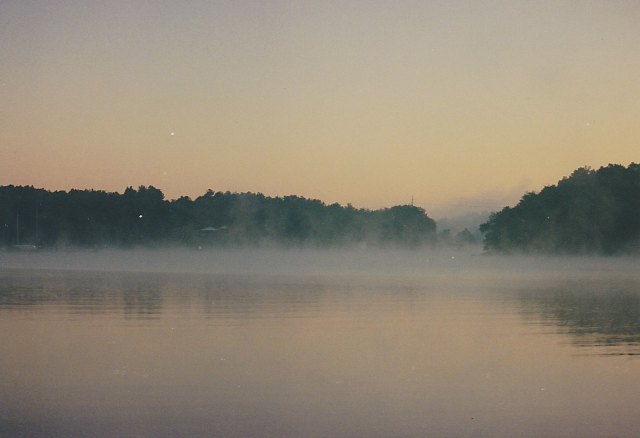
   I awoke early the next morning, just after first light, excited by the feeling of coolness in the air. The view out our big salon windows was striking. It was about 6 a.m. and there were plumes of mist rising into the comparatively cold air from the glassy calm water. Our electronic weather station in the cabin indicated that it was 54 outside and only 64 in the interior of the boat. I did not want to start the generator to heat the boat because that would surely wake Nancy, but hanging over the table in the salon we had a beautiful brass oil lamp, the "trawler lamp" as we called it. This provided appreciable heat as well as good light, so I lit the lamp, brought our portable computer from the office in the front cabin to the salon table, and worked on my writing for more than an hour until Nancy awoke. After our customary pills, juice and coffee I returned to my writing work, this time in the office with the generator running to charge our batteries. I continued working till almost noon and felt great satisfaction from accomplishing more than I had in any one day for a long time.

    We stayed on the boat for the remainder of the day, watching a little college football and doing some light boat work, but mainly talking, getting out our charts and guides, discussing our cruising plans for the remainder of our tour of the Chesapeake. We decided to remain on St. Leonard Creek for the rest of the weekend, but after that we resolved to try to visit two other locations that held our interests before heading south to North Carolina or beyond. The first was St. Marys City, which was located on St. Marys River, which flowed into the Potomac not far above its mouth. Not only was this small town the home of St. Marys College of Maryland, it was the fourth permanent settlement in British North America and the location of a museum and active archeological dig. (The charts and guides do not use an apostrophe in these names.) This was about a day's cruise and fifty miles from our current location. Following our visit to St. Marys, we wanted to cruise to Urbanna, Virginia, a small water-based town on the Rappahannock River about 85 miles farther south from St. Marys. While in the Bahamas on our long cruise in 1994 we had met the captain of a charter boat who made his home in Urbanna, and his descriptions of this town together with the various materials we had read piqued our interests. Of course these plans were subject to the usual vagaries of the weather, but at least we now had some goals.

Lush Tropical Surroundings At Vera's White Sands Resort, Solomons, Maryland

    On Sunday afternoon we visited Vera's using Recess to travel the mile down the creek from our anchorage. When we landed at the marina docks we found them to be somewhat in a state of disrepair but probably adequate for our use. Once again we wondered if perhaps the rates would be low enough for us to consider this location for our home next summer. The marina was deserted so we walked up the hill to the restaurant. The appearance of the building was striking, lushly tropical surrounded by exotic plants, palm trees and totem poles. We entered the restaurant and found the interior even more fantastic with all sorts of carvings and artifacts apparently from Hawaii and Polynesia and Africa. There were inlayed tables supported by carved elephants, shells and wicker chairs, diving helmets, giant turtle shells, bar stools and a bar covered in some kind of leopard print, Hawaiian music playing softly in the background and a huge painting of a woman covered with peacock feathers. The only person inside was the bartender who introduced himself as Carlos. He informed us that the kitchen was closed, but he said that he would be glad to make us a couple of mai tais if we cared to sit at the bar. These turned out to be large and good, and we slowly sipped on them while Carlos told us the story of Vera. She was the woman in the painting, he said. She was almost ninety, swims and runs every day, and still personally oversees everything at the resort. She was a Hollywood starlet who married a very successful doctor known as the "ophthalmologist to the stars." They made lots of money on real estate, Carlos told us, before her husband died, leaving Vera a very wealthy woman. For each of the past thirty years she had taken a world cruise and the furnishings in the restaurant were things she had collected in her travels. Could we possibly live in such a place and feel comfortable and at home? We tried to imagine having this as our local restaurant. But Carlos knew nothing about the marina and he did not expect any of the marina staff to come in for the remainder of the day. On our dinghy ride back to Summer School we had many unanswered questions. There was no doubt that we had experienced a fascinating and memorable afternoon.

Saturday, April 16, 2011

1800 Days – Seg. 17, Ch. 4, Pg. 10-14

    On Saturday, although we wanted to dinghy into Oxford again, it was still too breezy and choppy. We stayed onboard, read and rested, tended to small chores and checked over the boat. And we were disturbed by what we found. Once again, a voltage check showed that the batteries were not fully charged despite running the generator for 13 hours overnight. Worse yet, the foods and ice in the freezer compartment of our refrigerator showed signs that they were starting to thaw. Summer School was equipped with a typical marine refrigerator/freezer, a half size unit fitted into a compartment under the counter of the galley. This unit ran on 120 volt ac power if available from a dockside connection or our onboard generator. If these sources were not available, such as on Saturday morning after we shut down the generator, then the refrigerator automatically switched to 12 volt dc power from our house battery system. I reasoned that, if the battery voltage was low due to a lack of an adequate charge (for whatever reason), then the refrigerator may not be able to cool adequately, especially in the hot weather we were experiencing after the passage of Fran. We therefore decided to run the generator for an extended period and turned it on at 2 p.m., not to be turned off again until 8 a.m. Sunday morning. When we checked the refrigerator at that time our situation was much worse. All the foods in the freezer were thawed.

    It was imperative that we solve this problem if we were to continue our cruise, and our lives, as planned. Was our refrigerator simply failing, requiring us to replace it at substantial cost, perhaps several thousands? If this were the case we would have to spend significant time living in a marina somewhere while we got the unit replaced, which would completely disrupt our plans and our lives. This would be much worse than the problems we had with our air-conditioner.

    Once again I studied the manual for the refrigerator that came with the boat, looking for any hint or clue, and once again I read the specification that, if the refrigerator was mounted in an enclosed space, then that space should be vented with a minimum aperture of 35 square inches. I knew from looking at the vent cover on the outside of the cabin that the vent size was much smaller than this; the vent cover was only about two inches by four. In fact, for this reason I had long ago purchased a 5 by 9 louvered stainless steel vent cover with the intention of someday enlarging the vent to improve the performance of the refrigerator. But to this date our refrigerator had never failed us. On the other hand, we had not anchored for extended periods in weather as hot as what we experienced after Fran.

    There was one way to find out if the lack of adequate venting was the source of our difficulties, and that was to remove the refrigerator from its compartment and see if its performance improved. Although I hated to disrupt the interior of our cabin, I removed the mounting screws and was able to slide the refrigerator out of its compartment and onto the cabin sole without having to disconnect it. I was shocked by what I found. The compartment was not vented at all! The small vent that I could see on the outside of the cabin had been misplaced. That vent hole, which assuredly was meant for the refrigerator, opened underneath the galley sink instead! The wonder was that the refrigerator had been able to operate at all.

    Looking back on our actions on that Sunday morning I wonder at our boldness, but there seemed very little choice at the time. We had to get this problem resolved, and do it ourselves if at all possible. So I restarted the generator at 9 a.m. to provide power for my drill and saw, ran an extension cord onto the outside deck, and, after measuring very carefully, cut a large rectangular hole in the side of the boat. By noon the 5 by 9 vent cover had been mounted and sealed, and the refrigerator replaced in its compartment.

    We turned off the generator and waited. This would be a difficult test since the refrigerator was now running off the batteries and the outside temperature was again in excess of 90 degrees. We were encouraged by the fact that by evening the ice cube trays had started to freeze again though the meats in the freezer compartment were still soft.

    The NOAA weather forecast that night was the best we had heard for almost a week, with predicted hot temperatures but light winds and calm sees on the Chesapeake. If we were going to proceed with our plans to ascend the Potomac and visit Washington this might be the best time to cross the bay. We decided to leave the next morning if the forecast held, cross the bay and anchor somewhere in the Solomons area near the mouth of the Patuxent River.

    We were awake early on Monday morning. The NOAA weather broadcast was still the same, calm waters and light winds, so we got underway as quickly as possible. We left the protected anchorage at Trippe Creek by 8 a.m. to cruise the 45 miles across the bay and southward to the mouth of the Patuxent River. We reasoned that we would anchor overnight there and, if the refrigerator was working well and the boat was otherwise functioning properly, we would leave the next day to head south to the mouth of the Potomac and thence upriver toward Washington. On the other had if the refrigerator was still malfunctioning, or if there were any other significant problems, we would be close to Solomons, which had many marinas and repair facilities.

    On that Monday we were treated to an unusual experience on the Chesapeake. During the entire day the water, even out in the main shipping channel in the middle of the bay, was perfectly calm and flat. It was truly like glass with perfect reflections of the sky. Any disturbance, such as a ripple or a boat wake, could be seen from far away. We saw a number of areas where there were what we call fish boils - areas in the water where the surface was roiled by numerous fish feeding and trying to escape predators. We stopped briefly to fish one of these and easily caught five striped bass and a nice sized blue fish. By 3 p.m. we had entered the mouth of the Patuxent, continued past Sandy Point and the entrance to Solomons harbor, and rounded Point Patience off which the water was, incredibly, more than a hundred feet deep in the middle of the river. We tucked into Mill Creek on the western side of the river (not to be confused with the Mill Creek that flows into the harbor at Solomons) and dropped our anchor in a protected cove under the supervision of two beautiful swans. We were home for another night.

    After settling into our anchorage a check of the refrigerator showed that everything in the freezer was hard frozen; the cutting of the vent hole in the side of the cabin had worked and the refrigerator was probably working better than it ever had.

    Although we still had the problem of the batteries not charging fully when the charger was running off the generator, we thought we could live with this for awhile, at least until we got to a marina in Washington. So we settled in to a hot night on Mill Creek and made our plans to start for Washington and the Potomac early the next morning. Once again, however, Hurricane Fran forced us to change our plans. We learned, when we watched late night news from a Washington channel, that the Potomac was experiencing its worst flood in a hundred years due to all the rain dropped by Fran in the Potomac watershed. Whole trees and parts of buildings were being carried down the river by a current that was described as savage. There was no way we could fight against that current for a hundred miles and cope with all the debris in the water. A cruise up the Potomac and a visit to Washington would have to wait for another time. Of course we had no way of knowing that this anticipated cruise up the Potomac, when it came, would be part of the last cruise we would ever make in Summer School.

Sunday, April 3, 2011

1800 Days – Seg. 16, Ch. 4, Pg. 5-10


    By Monday afternoon most of the boats that had been visiting Chestertown had left. The holiday weekend was over. We departed as well, hauling our anchor at about 3 p.m. We only went about nine miles downriver to anchor one more time in Comegys Bight, the only boat in this pretty little bay that we liked so well.
    Our strategy in making such a short cruise was to position ourselves close enough to Kent Narrows to be there at high tide, about 10 a.m. on Tuesday morning. This, we felt, was crucial. The approach to Kent Narrows from the Chester was notorious for shallow water and shoaling with a high probability for first-time users such as ourselves to run aground. We would need every inch of depth we could get. Additionally, when the tide was running strongly the current through the Narrows was supposed to be fierce. If we could get there at high tide the current through the narrow bridge opening probably would be more manageable though our charts showed that it would not by any means be slack. This no longer surprised us. From our previous boating experience we knew that there was often a significant offset between the times of slack current and the times of high or low tide.
    On Tuesday morning we were up before seven and underway by 8 a.m. Two hours later, despite having considerable difficulty in finding the channel leading from the Chester to Kent Narrows (it was not as shown on the chart and had apparently been recently moved), we were in front of the Kent Narrows bridge waiting for it to open. As near as we could tell it was exactly high tide, though the current was still running strongly from the Chester toward Eastern Bay, pushing us toward the bridge and making it difficult to hold our position. To our relief the bridge tender seemed very knowledgeable about the problems of handling boats in strong currents (this was sometimes not the case we had found), and when he opened the bridge he used a loud PA system to instruct boats waiting on the other side of the bridge to stand back while we rode the swift current through the narrow opening.
    As soon as we entered Eastern Bay we knew that we were in different waters than in the Chester River drainage basin. We saw swimming crabs and stinging jelly fish, called nettles by the locals, everywhere.
    We followed our plotted course south about ten miles, past the wide opening to the main part of the Chesapeake, until we came to the mouth of the Wye River off Bennett Point at the end of a thin strip of land called Piney Neck. There we proceeded carefully across the shoals off the point (there were two marker buoys to help us) and turned north up the Wye River toward Wye Island. The charts showed the main channel of this river to be very deep with usual depths of 30 to 40 feet and sometimes as much as 50 to 60 feet deep. After the shallow water we had been through it was a pleasure to cruise through such depths, though we had to be attentive not to stray too far from the main channel, as we soon discovered, because the water shoaled quickly on either side. We planned to continue to follow the main Wye River north, past the mouth of the Wye East River that marked the tip of Wye Island. There were several places that promised good anchorages north of the island. We intended to take two or three days to explore ashore by dinghy and, finally, to circumnavigate the island before coming back out on the Wye East River on our way to Oxford and the Choptank River area.
    As we cruised slowly up the river we came fairly close to the shore of Piney Neck on our west. After about two miles we came abreast of a large stately house with extensive grounds, and all over the lawn and in the waters near the shoreline was a large flock of Canada geese. In addition we saw a flock of brilliant white swans. They were stunning in their grace and beauty. And then Nancy yelled at me to watch the depth gage, we were in the shallows. In my excitement over the geese and swans I had allowed the boat to drift too close to shore. But, thanks to Nancy's attentiveness, no harm was done and I turned back into the main channel, thrilled by the sight of these magnificent birds and eagerly anticipating the prospect of exploring this area over the next several days. Less than a mile beyond the house we rounded a large point of land, Drum Point according to the charts, extending from Wye Island on our right. On the other side of the point we entered a sheltered bay and there we decided to stay. We had this seemingly secluded anchorage all to ourselves throughout the night.
    Wednesday morning arrived early and abruptly in the form of wakes that threatened to rock us out of bed. These, we found, were due to work boats traveling up and down the main river channel as well as two boats that were tending crab traps in our little bay. But there was nowhere we had to go on this day. Maybe we would just travel a little around the shore of Wye Island. We could take it easy, get naps and have a restful time. So we eased into the morning, lingering over coffee, juice and toast, talking about how we would explore the area.
    Finally, at 10 a.m. we turned on the VHF radio and listened to the NOAA weather broadcast, and that changed everything. We were shocked to learn that there was yet another hurricane coming, Hurricane Fran, and it was forecast to come ashore in North Carolina and move up the Chesapeake. It was stated that the weather on the Chesapeake was expected to deteriorate as early as the next day, Thursday. It was evident that, if we were going to get to Oxford and the Choptank, we had better leave immediately or we would risk being windbound on the Wye River where there was no nearby town where we could resupply if that became necessary. We scurried about getting everything ready, finally hauling our anchor and getting underway by 11:15. How quickly our plans had changed!
    It was about a 45 mile cruise to Oxford and there was no short cut this time to keep us in sheltered waters. We had to proceed out the mouth of Eastern Bay south of Kent Island, all the way to the main shipping channel of the Chesapeake to skirt the shoals off Poplar, Jefferson and Coaches Islands. As we approached the main body of the Chesapeake we encountered southerly winds to 20 knots that resulted in head seas of about four feet. We left the bridge and went below in the cabin to use the lower helm station where it was less bouncy and out of the wind. This was the roughest water we had encountered since our tour of the Bahamas. Every wave produced a shower of spray over the bow that crashed onto the front window. We had to round Tilghman Island to enter the broad mouth of the Choptank and there is extensive shoaling that extends for more than six miles off the southern tip of the island. Fortunately we were able to carefully cross these shoals using a path that had adequate depths for our boat. Once we were into the Choptank the water calmed appreciably. We headed upriver toward Oxford, which is situated on the neck of land where the Tred Avon River enters the Choptank. Up the Tred Avon, about two miles past the Oxford waterfront, we turned into Trippe Creek, which made off to our right. A mile up the creek we rounded a sharp point of land at a narrows and carefully favored the south shore. We were in what was really like a little bay about a half mile wide but very well protected. Charted depths were 7 to 10 feet. Perfect, we thought, not too deep yet with adequate swinging room. We could safely let out a lot of anchor line to give us the large scope necessary to withstand high winds. It was late, almost 6 p.m., when we dropped our anchor. It had been a boisterous ride but we were now in a spot that we thought would be a good hurricane hole and it was only three miles from Oxford where there were restaurants, marinas and stores for reprovisioning.
A Marina in Oxford: Swans Are Common

    The Trippe Creek anchorage was our home for the next five days and I have nothing but good memories of this time despite Hurricane Fran. On Thursday, the day after we arrived, we took Recess into town where we found a convenient dinghy dock at a restaurant. We had an excellent lunch, disposed of our accumulated trash from the boat, and got a cooler full of ice for our drinks. On our return trip to Summer School in the early afternoon the winds increased and the water became sufficiently choppy that we were taking in spray over the bow of our little inflatable dinghy. Back onboard, NOAA weather radio confirmed that Fran had come ashore in North Carolina and was expected to churn up the Chesapeake still at hurricane strength. We set out a second anchor and adjusted our lines to give us plenty of scope. We were about as well protected as we could hope to be.
    I slept little on Thursday night as the winds increased, preferring to stay awake to watch the radar, GPS receiver and depth gage so that I could detect any appreciable movement of the boat caused by anchor dragging. I dozed fitfully through the early morning hours as the winds seemed to be holding steady at around 30 mph. I was glad when dawn finally came and revealed our bay to be covered in whitecaps. The early morning weather report brought good news, at least for us. Fran was tracking west of the Chesapeake and we would miss the worst of the storm. As the day wore on the winds increased somewhat to 35 mph but we were secure and unworried in our anchorage. In the afternoon Nancy and I sat in our small cockpit at the back of the boat, warmly comfortable and shielded from the wind. We still had a few chicken necks in the freezer compartment left over from Rolph's, and we used these to crab from the back of the boat. By dinner time we had caught eight beautiful large blue crabs and these became the main course of our dinner. Altogether it was an enjoyable and memorable afternoon. I was aware that there must have been some storm surge due to Fran because there was a house on the shore about a half mile away that had a boat dock, and the dock, as best as I could see, had disappeared under the water. However, since we were at anchor we merely rose with the water level, which had essentially no effect on us. By nightfall the winds had started to diminish and the temperature had increased substantially due to the tropical air brought into the region by the hurricane. The low temperature never got less than 75 overnight but we had our generator and air-conditioner. We were comfortable.
House on the Shore at Trippe Creek Anchorage
Dock Submerged by Rising Waters from Hurricane Fran


Restaurant on the Shore in Oxford
Flooded at High Tide During Hurricane Fran